File:Karte Baiersbronn.png
Size of this preview: 731 × 599 pixels. Other resolutions: 293 × 240 pixels | 585 × 480 pixels | 1,000 × 820 pixels.
Original file (1,000 × 820 pixels, file size: 137 KB, MIME type: image/png)
Captions
Captions
Add a one-line explanation of what this file represents
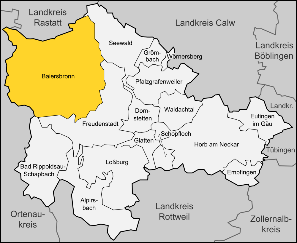
| Description | Karte der Gemeinde Baiersbronn im Landkreises Freudenstadt |
| Date | |
| Source | "own work", used Karte Landkreis Freudenstadt.svg by Lencer |
| Author | Lencer |

|
This map has been made or improved in the German Kartenwerkstatt (Map Lab). You can propose maps to improve as well.
|
Licensing
edit
This file is licensed under the Creative Commons Attribution-Share Alike 3.0 Unported license.
- You are free:
- to share – to copy, distribute and transmit the work
- to remix – to adapt the work
- Under the following conditions:
- attribution – You must give appropriate credit, provide a link to the license, and indicate if changes were made. You may do so in any reasonable manner, but not in any way that suggests the licensor endorses you or your use.
- share alike – If you remix, transform, or build upon the material, you must distribute your contributions under the same or compatible license as the original.
File history
Click on a date/time to view the file as it appeared at that time.
| Date/Time | Thumbnail | Dimensions | User | Comment | |
|---|---|---|---|---|---|
| current | 19:18, 1 June 2015 | | 1,000 × 820 (137 KB) | Cmdrjameson (talk | contribs) | Compressed with pngout. Reduced by 71kB (34% decrease). |
| 19:18, 1 June 2015 |  | 1,000 × 820 (137 KB) | Cmdrjameson (talk | contribs) | Compressed with pngout. Reduced by 71kB (34% decrease). | |
| 17:39, 14 November 2008 |  | 1,000 × 820 (208 KB) | Lencer (talk | contribs) | {{Information |Description= Karte der Gemeinde Baiersbronn im Landkreises Freudenstadt |Source="own work", used Karte Landkreis Freudenstadt.svg by [[User:Len |
You cannot overwrite this file.
File usage on Commons
The following 6 pages use this file:
File usage on other wikis
The following other wikis use this file:
- Usage on als.wikipedia.org
- Usage on ar.wikipedia.org
- Usage on de.wikipedia.org
- Usage on en.wikipedia.org
- Usage on eo.wikipedia.org
- Usage on es.wikipedia.org
- Usage on eu.wikipedia.org
- Usage on hu.wikipedia.org
- Usage on it.wikipedia.org
- Usage on lb.wikipedia.org
- Usage on lmo.wikipedia.org
- Usage on nl.wikipedia.org
- Usage on pl.wikipedia.org
- Usage on ro.wikipedia.org
- Usage on sh.wikipedia.org
- Usage on sr.wikipedia.org
- Usage on sv.wikipedia.org
- Usage on tt.wikipedia.org
- Usage on uk.wikipedia.org
- Usage on www.wikidata.org