File:Reliefkarte Bourgogne-Franche-Compte.png
Size of this preview: 624 × 600 pixels. Other resolutions: 250 × 240 pixels | 500 × 480 pixels | 799 × 768 pixels | 1,066 × 1,024 pixels | 2,132 × 2,048 pixels | 3,520 × 3,382 pixels.
Original file (3,520 × 3,382 pixels, file size: 14.76 MB, MIME type: image/png)
Captions
Captions
Add a one-line explanation of what this file represents
| Description |
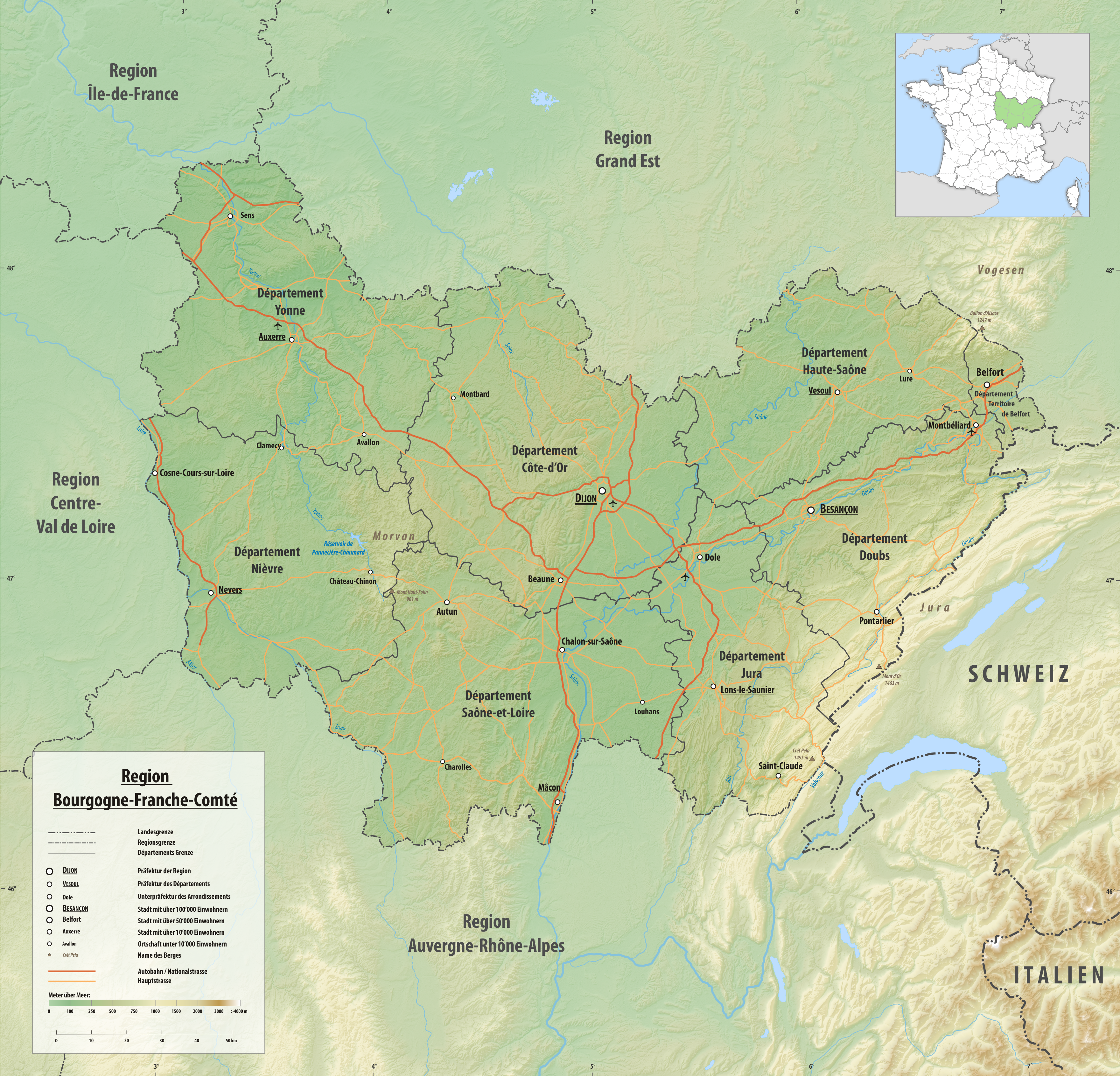
Deutsch: Reliefkarte der Region Bourgogne-Franche-Compte
Topographischer Hintergrund: NASA Shuttle Radar Topography Mission (public domain). SRTM3 v.2. |
||||||||
| Date | |||||||||
| Source | Own work | ||||||||
| Author | Tschubby | ||||||||
| Permission (Reusing this file) |
I, the copyright holder of this work, hereby publish it under the following licenses:
This file is licensed under the Creative Commons Attribution-Share Alike 2.5 Generic, 2.0 Generic and 1.0 Generic license.
You may select the license of your choice. |

File history
Click on a date/time to view the file as it appeared at that time.
| Date/Time | Thumbnail | Dimensions | User | Comment | |
|---|---|---|---|---|---|
| current | 21:37, 14 March 2018 | | 3,520 × 3,382 (14.76 MB) | Tschubby (talk | contribs) | {{Information |description= |source= |date= |author= |permission= |other versions= }} |
| 10:51, 1 November 2016 |  | 3,521 × 3,384 (15.02 MB) | Tschubby (talk | contribs) | {{Information |Description= {{de| Reliefkarte der Region Bourgogne-Franche-Compte}} Topographischer Hintergrund: [http://www2.jpl.nasa.gov/srtm NASA Shuttle Radar Topography Mission] (public domain). SRTM3 v.2. |Source={{own}} |Date= 2016-11-01 |Author... |
You cannot overwrite this file.
File usage on Commons
There are no pages that use this file.
File usage on other wikis
The following other wikis use this file:
- Usage on als.wikipedia.org
- Usage on frr.wikipedia.org
- Usage on simple.wikipedia.org