File:Rheinbrücke Emmerich Gesamtansicht.jpg
Original file (3,050 × 1,100 pixels, file size: 1.13 MB, MIME type: image/jpeg)
Captions
Captions
Summary
edit| Description |
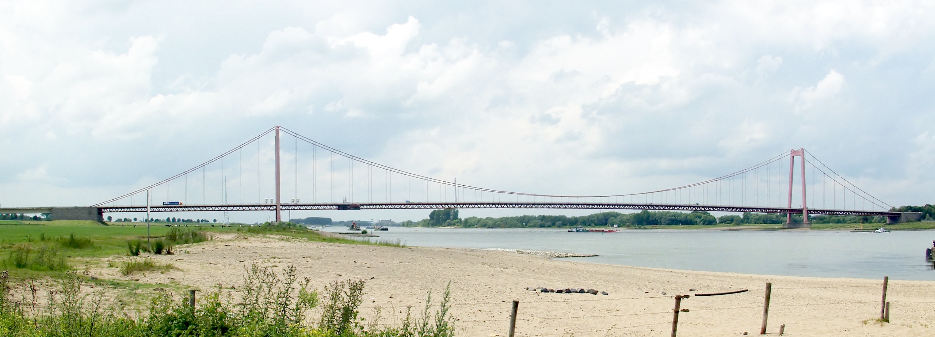
Deutsch: Rheinbrücke Emmerich
English: Brigde over the Rhine at Emmerich, Germany |
|||||||||||||||||
| Date | ||||||||||||||||||
| Source | Own work | |||||||||||||||||
| Author |
|
|||||||||||||||||
| Permission (Reusing this file) |
|
|||||||||||||||||
| Attribution (required by the license) | © Raimond Spekking / | |||||||||||||||||


| Camera location | | View this and other nearby images on: OpenStreetMap |
|---|
Licensing
edit
I have published this image as author under the Creative-Commons-Licence CC BY-SA 4.0.. This means that free online usage outside of Wikimedia projects under the following terms of licence is possible:
- The image is credited with "© Raimond Spekking / CC BY-SA 4.0 (via Wikimedia Commons)"
For all other kind of usages (books, journales, flyers, etc.) click on the following button. You will get all information needed.
I would be happy to receive a specimen copy or the URL of the website where the image is used.
Please write an email to raimond.spekking@gmail.com (GPG encrypted emails are welcome: Key-ID: 0xB12BE7A6), if you
- need the image in a higher resolution
- need my postal address for sending a specimen copy
- have further questions to the terms of licence
- You are free:
- to share – to copy, distribute and transmit the work
- to remix – to adapt the work
- Under the following conditions:
- attribution – You must give appropriate credit, provide a link to the license, and indicate if changes were made. You may do so in any reasonable manner, but not in any way that suggests the licensor endorses you or your use.
- share alike – If you remix, transform, or build upon the material, you must distribute your contributions under the same or compatible license as the original.
File history
Click on a date/time to view the file as it appeared at that time.
| Date/Time | Thumbnail | Dimensions | User | Comment | |
|---|---|---|---|---|---|
| current | 20:03, 14 September 2010 | 3,050 × 1,100 (1.13 MB) | Raymond (talk | contribs) | improved version | |
| 19:06, 7 September 2006 | 2,000 × 578 (361 KB) | Raymond (talk | contribs) | {{Information |Description={{de|de:Rheinbrücke Emmerich}}{{en|Brigde over the Rhine at Emmerich, Germany}} |Source=own photography |Date=8. Jul. 2004 |Author=~~~ - Raimond Spekking |Permission= |other_versions= }} {{User:Raymond de/licence}} |
You cannot overwrite this file.
File usage on Commons
The following 6 pages use this file:
File usage on other wikis
The following other wikis use this file:
- Usage on als.wikipedia.org
- Usage on arz.wikipedia.org
- Usage on azb.wikipedia.org
- Usage on be.wikipedia.org
- Usage on de.wikipedia.org
- Usage on de.wikivoyage.org
- Usage on en.wikipedia.org
- Usage on eo.wikipedia.org
- Usage on fr.wikipedia.org
- Usage on hr.wikipedia.org
- Usage on hu.wikipedia.org
- Usage on nl.wikipedia.org
- Usage on ru.wikipedia.org
- Usage on www.wikidata.org