File:Main catchment.png
Original file (1,200 × 856 pixels, file size: 2.14 MB, MIME type: image/png)
Captions
Captions
Summary
edit
| Description |
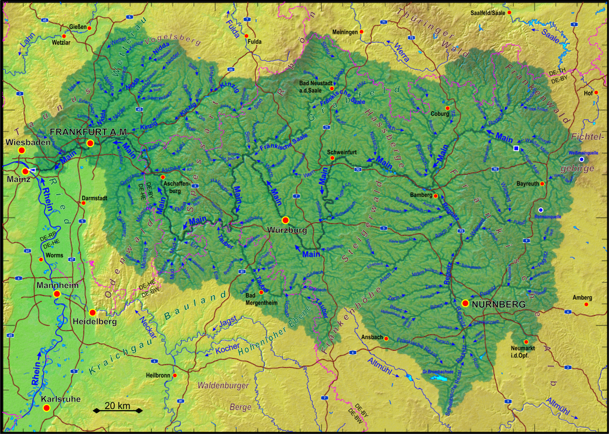
Deutsch: Einzugsgebiet des Mains
English: Catchment area of the Main river |
| Date | |
| Source |
Own work based on open data provided by OpenStreetMap contributers (https://www.openstreetmap.org), Bayerische Vermessungsverwaltung DGM1 (https://geodaten.bayern.de/opengeodata), Thüringer Landesamt für Bodenmanagement und Geoinformation DGM2 (https://www.geoportal-th.de/de-de/Downloadbereiche/Download-Offene-Geodaten-Thüringen), Hessische Verwaltung für Bodenmanagement und Geoinformation DGM1 (https://hvbg.hessen.de/geoinformation/open-data), ASTER Digital Elevation Model data by https://lpdaac.usgs.gov/, and results of own runoff calculations. |
| Author | Periphrastika |
Licensing
edit
- You are free:
- to share – to copy, distribute and transmit the work
- to remix – to adapt the work
- Under the following conditions:
- attribution – You must give appropriate credit, provide a link to the license, and indicate if changes were made. You may do so in any reasonable manner, but not in any way that suggests the licensor endorses you or your use.
- share alike – If you remix, transform, or build upon the material, you must distribute your contributions under the same or compatible license as the original.
File history
Click on a date/time to view the file as it appeared at that time.
| Date/Time | Thumbnail | Dimensions | User | Comment | |
|---|---|---|---|---|---|
| current | 11:03, 18 January 2024 | | 1,200 × 856 (2.14 MB) | Periphrastika (talk | contribs) | more details |
| 07:34, 30 March 2018 |  | 1,318 × 1,080 (1.7 MB) | Periphrastika (talk | contribs) | more lables (major cities, mountains, rivers) | |
| 15:42, 4 March 2018 |  | 1,320 × 1,078 (1.63 MB) | Periphrastika (talk | contribs) | User created page with UploadWizard |
You cannot overwrite this file.
File usage on Commons
The following page uses this file:
File usage on other wikis
The following other wikis use this file:
- Usage on als.wikipedia.org
- Usage on de.wikipedia.org
- Usage on en.wikipedia.org