File:Lage fluss inn.png
Size of this preview: 697 × 599 pixels. Other resolutions: 279 × 240 pixels | 558 × 480 pixels | 893 × 768 pixels | 1,191 × 1,024 pixels | 2,046 × 1,759 pixels.
Original file (2,046 × 1,759 pixels, file size: 3.95 MB, MIME type: image/png)
Captions
Captions
Add a one-line explanation of what this file represents
Summary
edit
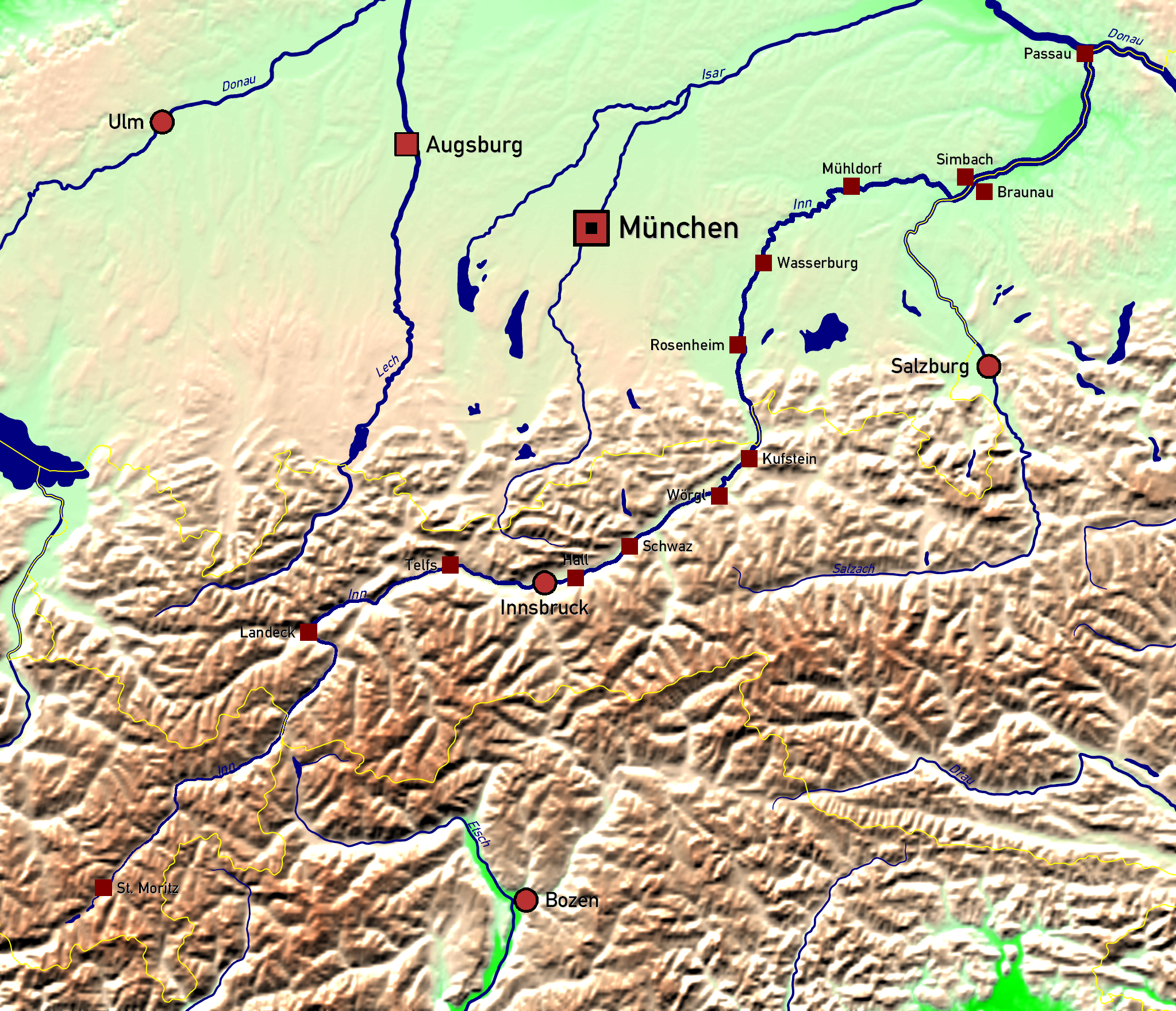
| Description | Verlauf des Flusses Inn. |
| Date | |
| Source | Own work |
| Author | User:Omnidoom 999 |
Licensing
edit
| I, the copyright holder of this work, release this work into the public domain. This applies worldwide. In some countries this may not be legally possible; if so: I grant anyone the right to use this work for any purpose, without any conditions, unless such conditions are required by law. |
File history
Click on a date/time to view the file as it appeared at that time.
| Date/Time | Thumbnail | Dimensions | User | Comment | |
|---|---|---|---|---|---|
| current | 16:15, 16 November 2009 | | 2,046 × 1,759 (3.95 MB) | Omnidom 999~commonswiki (talk | contribs) | smaller corrections |
| 21:27, 10 November 2009 |  | 2,040 × 1,870 (3.28 MB) | Omnidom 999~commonswiki (talk | contribs) | higher quality and newer version of this file | |
| 15:18, 5 June 2008 |  | 1,058 × 794 (964 KB) | Omnidom 999~commonswiki (talk | contribs) | {{Information |Description= Verlauf des FLusses Inn. |Source= eigenes Werk |Date= 2008|06|05 |Author= User:Omnidoom 999 |Permission= |other_versions= }} | |
| 11:57, 18 February 2006 |  | 757 × 530 (396 KB) | Omnidom 999~commonswiki (talk | contribs) | {{Information| |Description = Zusehen ist die Lage des Flusses Inn |Source = selbst gemacht mit dem Programm MAP-CREATOR |Date = 18.02.2006 |Author = Niklas Dehne |Permission = |other_versions = }} |
You cannot overwrite this file.
File usage on Commons
The following page uses this file:
File usage on other wikis
The following other wikis use this file:
- Usage on af.wikipedia.org
- Usage on als.wikipedia.org
- Usage on be.wikipedia.org
- Usage on de.wikipedia.org
- Usage on fa.wikipedia.org
- Usage on hu.wikipedia.org
- Usage on id.wikipedia.org
- Usage on la.wiktionary.org
- Usage on lmo.wikipedia.org
- Usage on ro.wikipedia.org
- Usage on uk.wikipedia.org