File:Karte Ukraine.png
Original file (1,181 × 825 pixels, file size: 603 KB, MIME type: image/png)
Captions
Captions
Summary
edit| Description |
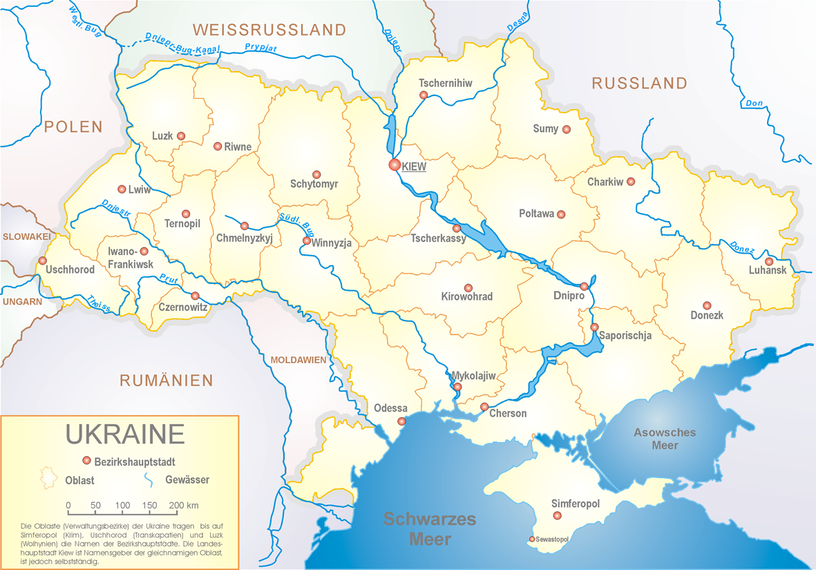
Deutsch: Ukraine, politische Gliederung English: Map of Ukraine's Oblasts and their administrative centers Svenska: Karta över Ukrainas oblast samt deras respektive centralorter |
||||||||||||||||||||||
| Source | Own work | ||||||||||||||||||||||
| Author |
|
||||||||||||||||||||||
| Other versions |
[]
|
||||||||||||||||||||||


Licensing
edit

|
Permission is granted to copy, distribute and/or modify this document under the terms of the GNU Free Documentation License, Version 1.2 or any later version published by the Free Software Foundation; with no Invariant Sections, no Front-Cover Texts, and no Back-Cover Texts. A copy of the license is included in the section entitled GNU Free Documentation License. |
| This file is licensed under the Creative Commons Attribution-Share Alike 3.0 Unported license. | ||
| ||
| This licensing tag was added to this file as part of the GFDL licensing update. |
|
Das Foto habe ich als Urheber unter der „GFDL – GNU-Lizenz für freie Dokumentation“ in der Wikipedia veröffentlicht. Dies bedeutet, dass eine kostenlose, auch kommerzielle Nutzung außerhalb der Wikimedia-Projekte unter folgenden Bedingungen möglich ist:
Ich bitte um Zusendung eines Belegexemplares bzw. der URL, wo das Foto benutzt wird. Bitte schreiben Sie eine E-Mail an steschke@web.de, wenn Sie
|
|
I have published this image as author under the "GNU Free Documentation License" in Wikipedia. This means that free, commercial usage outside of Wikimedia projects under the following terms of licence is possible:
Please send me a specimen copy or the URL of the website where the image is used. Please write an email to steschke@web.de, if you
|
Assessment
edit
|
File history
Click on a date/time to view the file as it appeared at that time.
| Date/Time | Thumbnail | Dimensions | User | Comment | |
|---|---|---|---|---|---|
| current | 20:17, 19 May 2016 | | 1,181 × 825 (603 KB) | NordNordWest (talk | contribs) | Dnipro |
| 21:17, 22 July 2005 |  | 1,181 × 825 (623 KB) | Steschke (talk | contribs) | Map of ukraine - polish by Sven Teschke {{Maps of Ukraine by Steschke}} {{GFDL}} Category:Maps of Ukraine |
You cannot overwrite this file.
File usage on Commons
The following 6 pages use this file:
File usage on other wikis
The following other wikis use this file:
- Usage on als.wikipedia.org
- Usage on ar.wikipedia.org
- Usage on ca.wikipedia.org
- Usage on cs.wikipedia.org
- Usage on de.wikipedia.org
- Liste der Oblaste der Ukraine
- Wikipedia:Kandidaten für exzellente Bilder/Archiv2004/4
- Universitäten in der Ukraine
- Benutzer Diskussion:Tschubby/Archiv 2004
- Portal:Ukraine
- Wikipedia Diskussion:Kandidaten für exzellente Bilder/Fotoausstellung zum 22C3
- Portal:Ukraine/Geografie
- Wikipedia:Fotowerkstatt/Archiv 2
- Datei:Karte Ukraine.png
- Wikipedia:Exzellente Bilder/Karten und Satellitenbilder
- Benutzer:Mikullovci11/Work/Karten
- Benutzer:Steschke/Galerie/Architektur
- Wikipedia:Exzellente Bilder/Kleine Bilder
- Grenze zwischen Rumänien und der Ukraine
- Usage on eml.wikipedia.org
- Usage on fr.wikipedia.org
- Usage on hr.wikipedia.org
- Usage on nds.wikipedia.org
- Usage on pl.wikipedia.org
- Usage on sl.wikipedia.org
- Usage on zh.wikipedia.org