File:Omaniempire1856cs.png
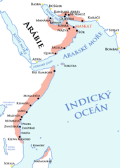
Size of this preview: 428 × 599 pixels. Other resolutions: 171 × 240 pixels | 343 × 480 pixels | 642 × 899 pixels.
Original file (642 × 899 pixels, file size: 150 KB, MIME type: image/png)
Captions
Captions
Add a one-line explanation of what this file represents
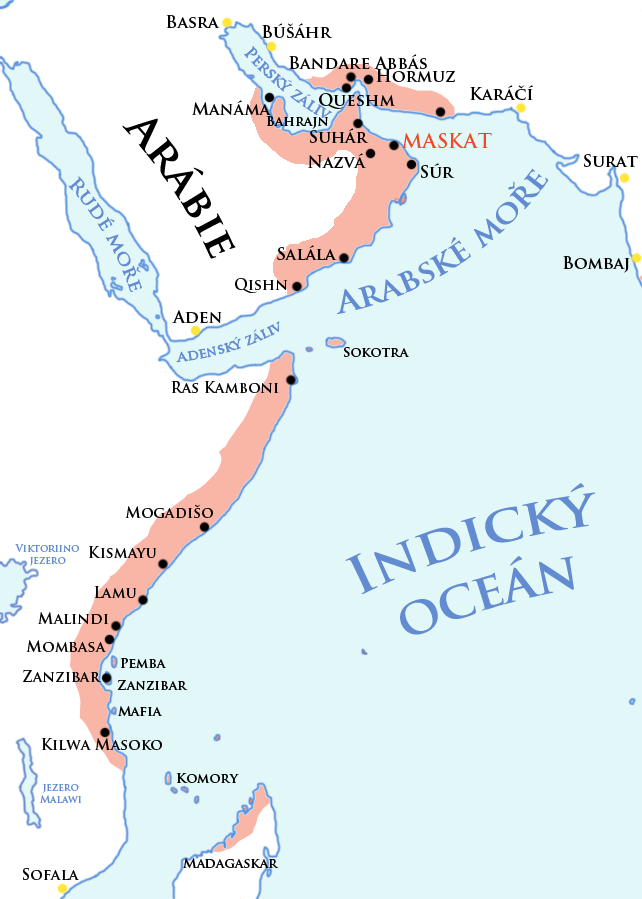
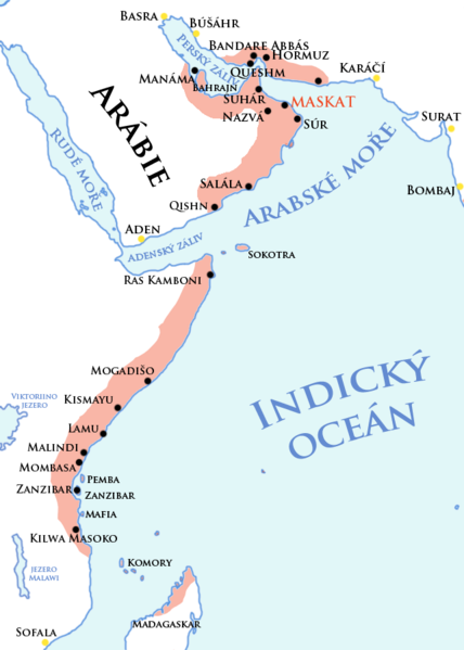
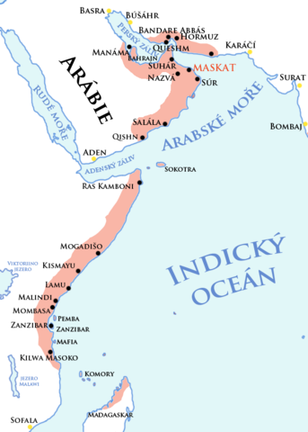
Území pod ománskou vládou
Významná města
Faktorie
| Description |
English: Map of Sultanate Muscat and Oman and its dependencies (Omani empire) in 1856 (before partition). Čeština: Mapa Sultanátu Muskat a Omán a území pod jeho vlivem (Ománská říše) roku 1856 (před rozdělením) |
| Date | (UTC) |
| Source | |
| Author |
|
| This is a retouched picture, which means that it has been digitally altered from its original version. Modifications: new grafic style, translation. The original can be viewed here: Omaniempire1856.png:
|
This file is licensed under the Creative Commons Attribution-Share Alike 3.0 Unported license.
- You are free:
- to share – to copy, distribute and transmit the work
- to remix – to adapt the work
- Under the following conditions:
- attribution – You must give appropriate credit, provide a link to the license, and indicate if changes were made. You may do so in any reasonable manner, but not in any way that suggests the licensor endorses you or your use.
- share alike – If you remix, transform, or build upon the material, you must distribute your contributions under the same or compatible license as the original.
Original upload log
edit
This image is a derivative work of the following images:
- File:Omaniempire1856.png licensed with PD-self
- 2009-04-22T23:29:55Z Nickpo 642x899 (227738 Bytes) {{Information |Description={{en|Map of Sultanate Muscat and Oman and its dependencies (Omani empire) in 1856 (before partition).}} {{ru|Карта Султаната Маскат и Оман и его владений (Ома
- 2009-04-22T18:31:07Z Nickpo 642x899 (227291 Bytes) {{Information |Description={{en|Map of Sultanate Muscat and Oman and its dependencies (Omani empire) in 1856 (before partition).}} {{ru|Карта Султаната Маскат и Оман и его владений (Ома
Uploaded with derivativeFX
File history
Click on a date/time to view the file as it appeared at that time.
| Date/Time | Thumbnail | Dimensions | User | Comment | |
|---|---|---|---|---|---|
| current | 11:26, 21 June 2010 | | 642 × 899 (150 KB) | Mozzan (talk | contribs) | {{Information |Description={{en|Map of Sultanate Muscat and Oman and its dependencies (Omani empire) in 1856 (before partition).}} {{cs|Mapa Sultanátu Muskat a Omán a území pod jeho vlivem (Ománská říše) roku 1856 (před rozdělením)}} |Source=* |
You cannot overwrite this file.
File usage on Commons
There are no pages that use this file.
File usage on other wikis
The following other wikis use this file:
- Usage on als.wikipedia.org
- Usage on cs.wikipedia.org
- Usage on de.wikipedia.org
- Usage on it.wikipedia.org
- Usage on ja.wikipedia.org
- Usage on sh.wikipedia.org
- Usage on sk.wikipedia.org
- Usage on zh.wikipedia.org