File:MapeLysonia.jpg
Size of this preview: 439 × 600 pixels. Other resolutions: 175 × 240 pixels | 351 × 480 pixels | 562 × 768 pixels | 749 × 1,024 pixels | 1,697 × 2,319 pixels.
Original file (1,697 × 2,319 pixels, file size: 649 KB, MIME type: image/jpeg)
Captions
Captions
Add a one-line explanation of what this file represents
Summary
edit
| Description |
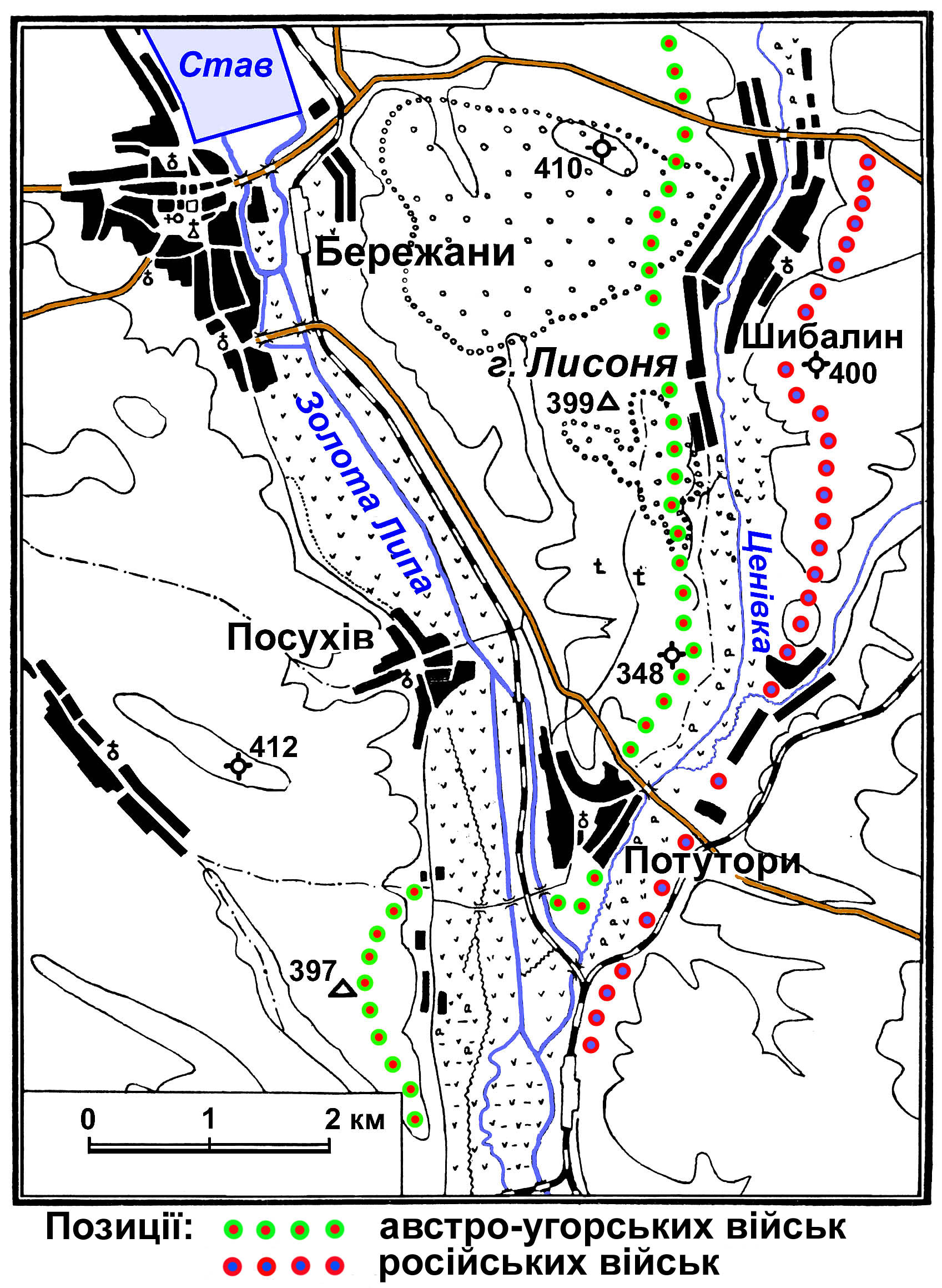
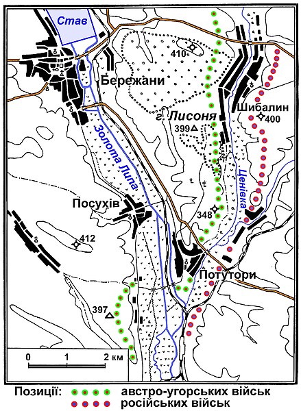
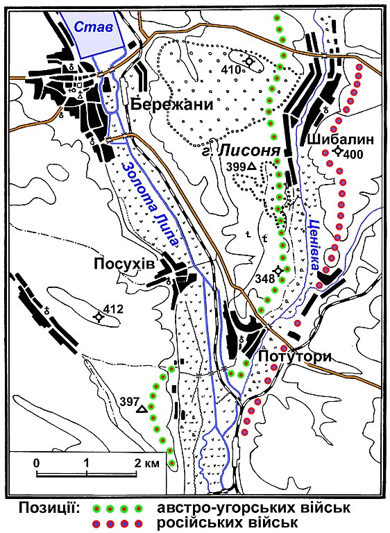
Українська: Схема розташування австро-угорських і російських військ поблизу Бережан на початок вересня 1916 року Позиції російських і австро-угорських військ, в складі яких був Легіон Українських січових стрільців, в битві на горі Лисоня. |
| Date | березень 2008 року |
| Source | Українські січові стрільці,1914 - 1920. За ред. Б.Гнаткевича та ін. - Львів, 1935. - 160 с. |
| Author | Реконструкцію мапи-схеми за джерелом виконав я сам - Едуард Плешаков |
Licensing
edit
| I, the copyright holder of this work, release this work into the public domain. This applies worldwide. In some countries this may not be legally possible; if so: I grant anyone the right to use this work for any purpose, without any conditions, unless such conditions are required by law. |
File history
Click on a date/time to view the file as it appeared at that time.
| Date/Time | Thumbnail | Dimensions | User | Comment | |
|---|---|---|---|---|---|
| current | 09:45, 4 March 2008 | | 1,697 × 2,319 (649 KB) | Едуард Плешаков (talk | contribs) | {{Зображення |Назва=Схема розташування австро-угорських і російських військ поблизу Бережан на початок вересня 1916 року |Опис=Позиції росій� |
You cannot overwrite this file.
File usage on Commons
The following page uses this file:
File usage on other wikis
The following other wikis use this file:
- Usage on uk.wikipedia.org
- Usage on www.wikidata.org