File:Ludwigskanal-Karte.jpg
Size of this preview: 702 × 600 pixels. Other resolutions: 281 × 240 pixels | 562 × 480 pixels | 899 × 768 pixels | 1,198 × 1,024 pixels | 1,280 × 1,094 pixels.
Original file (1,280 × 1,094 pixels, file size: 198 KB, MIME type: image/jpeg)
Captions
Captions
Add a one-line explanation of what this file represents
| Description |
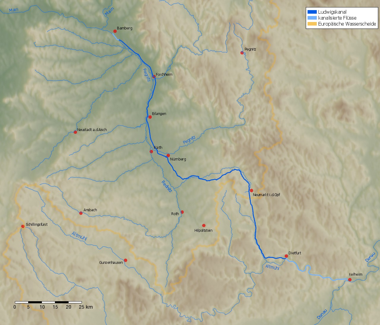
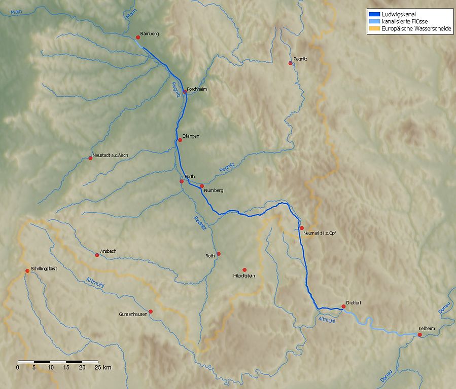
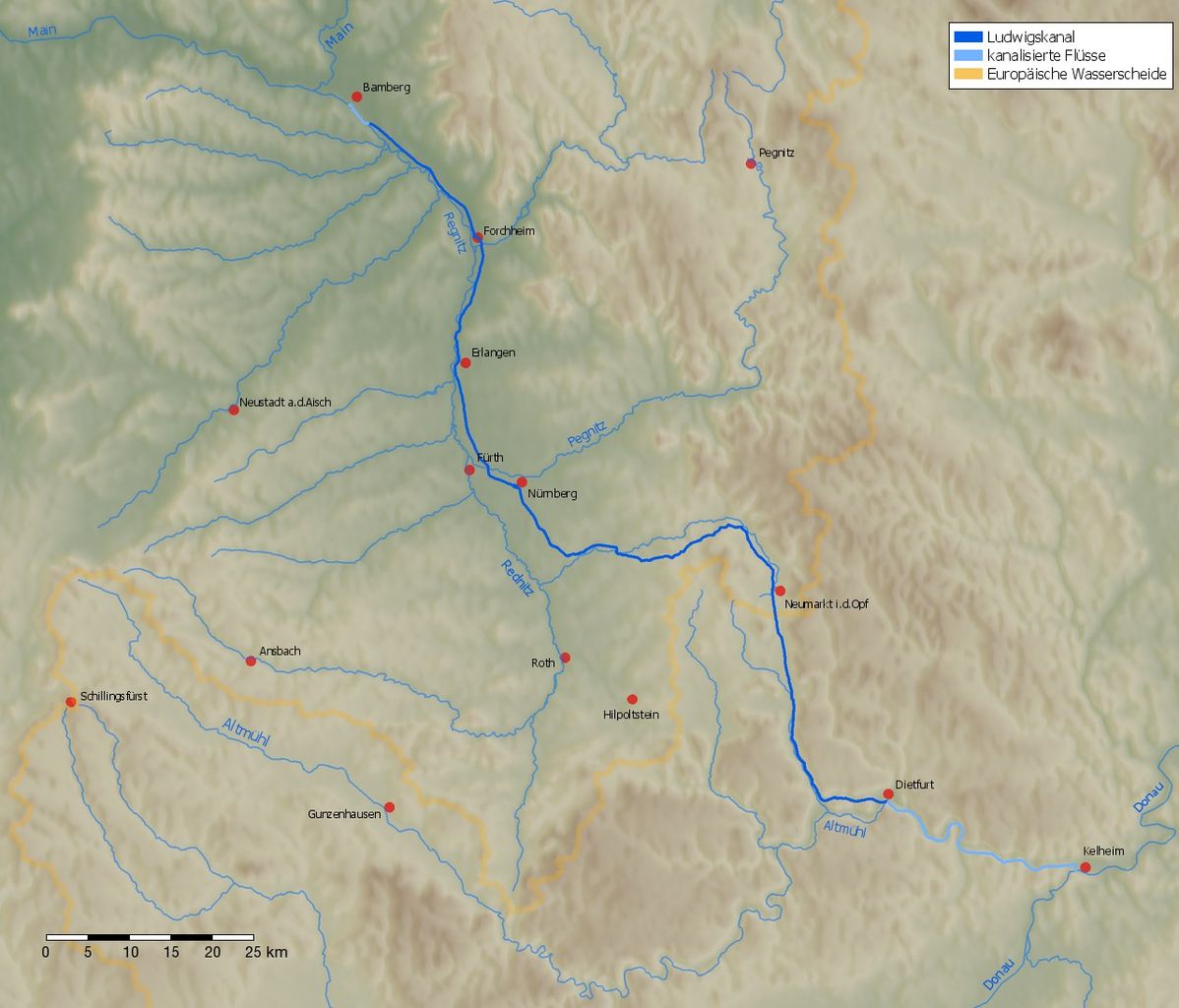
Deutsch: Karte des Ludwigskanals zwischen Main (Bamberg) und Donau (Kelheim).
English: Map of the Ludwigs Canal. |
| Date | |
| Source | Own work. The background was generated by the Generic Mapping Tools (GMT, http://gmt.soest.hawaii.edu) using the public domain data of the GLOBE project (http://www.ngdc.noaa.gov/mgg/topo/gltiles.html). |
| Author | jailbird |

|
This transport map image could be re-created using vector graphics as an SVG file. This has several advantages; see Commons:Media for cleanup for more information. If an SVG form of this image is available, please upload it and afterwards replace this template with
{{vector version available|new image name}}.
It is recommended to name the SVG file “Ludwigskanal-Karte.svg”—then the template Vector version available (or Vva) does not need the new image name parameter. |

This file is licensed under the Creative Commons Attribution-Share Alike 2.0 Germany license.
- You are free:
- to share – to copy, distribute and transmit the work
- to remix – to adapt the work
- Under the following conditions:
- attribution – You must give appropriate credit, provide a link to the license, and indicate if changes were made. You may do so in any reasonable manner, but not in any way that suggests the licensor endorses you or your use.
- share alike – If you remix, transform, or build upon the material, you must distribute your contributions under the same or compatible license as the original.

File history
Click on a date/time to view the file as it appeared at that time.
| Date/Time | Thumbnail | Dimensions | User | Comment | |
|---|---|---|---|---|---|
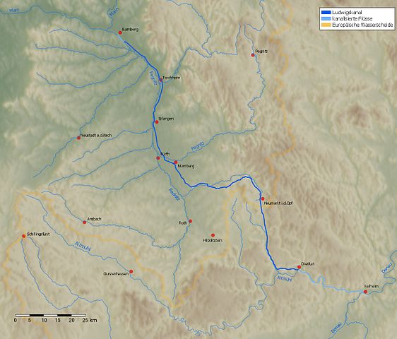
| current | 09:12, 19 June 2009 | | 1,280 × 1,094 (198 KB) | Jailbird (talk | contribs) | Maßstabsleiste hinzugefügt |
| 14:42, 24 January 2007 |  | 1,280 × 1,094 (197 KB) | Jailbird (talk | contribs) | *Karte des Ludwigskanals zwischen Main (Bamberg) und Donau (Kelheim). Das Bild wurde von mir am 24.1.2007 selbst erstellt. Das Hintergrundbild wurde mit den Generic Mapping Tools (GMT, http://gmt.soest.hawaii.edu) unter Verwendung der |
You cannot overwrite this file.
File usage on Commons
The following 5 pages use this file:
File usage on other wikis
The following other wikis use this file:
- Usage on arz.wikipedia.org
- Usage on da.wikipedia.org
- Usage on de.wikipedia.org
- Usage on en.wikipedia.org
- Usage on es.wikipedia.org
- Usage on ka.wikipedia.org
- Usage on mk.wikipedia.org
- Usage on nl.wikipedia.org
- Usage on ru.wikipedia.org
- Usage on sv.wikipedia.org
- Usage on uk.wikipedia.org
- Usage on www.wikidata.org