File:Slavonia region cities map.png

Size of this preview: 800 × 537 pixels. Other resolutions: 320 × 215 pixels | 640 × 429 pixels | 1,024 × 687 pixels | 1,431 × 960 pixels.
Original file (1,431 × 960 pixels, file size: 68 KB, MIME type: image/png)
Captions
Captions
Add a one-line explanation of what this file represents
Summary
edit| Description |
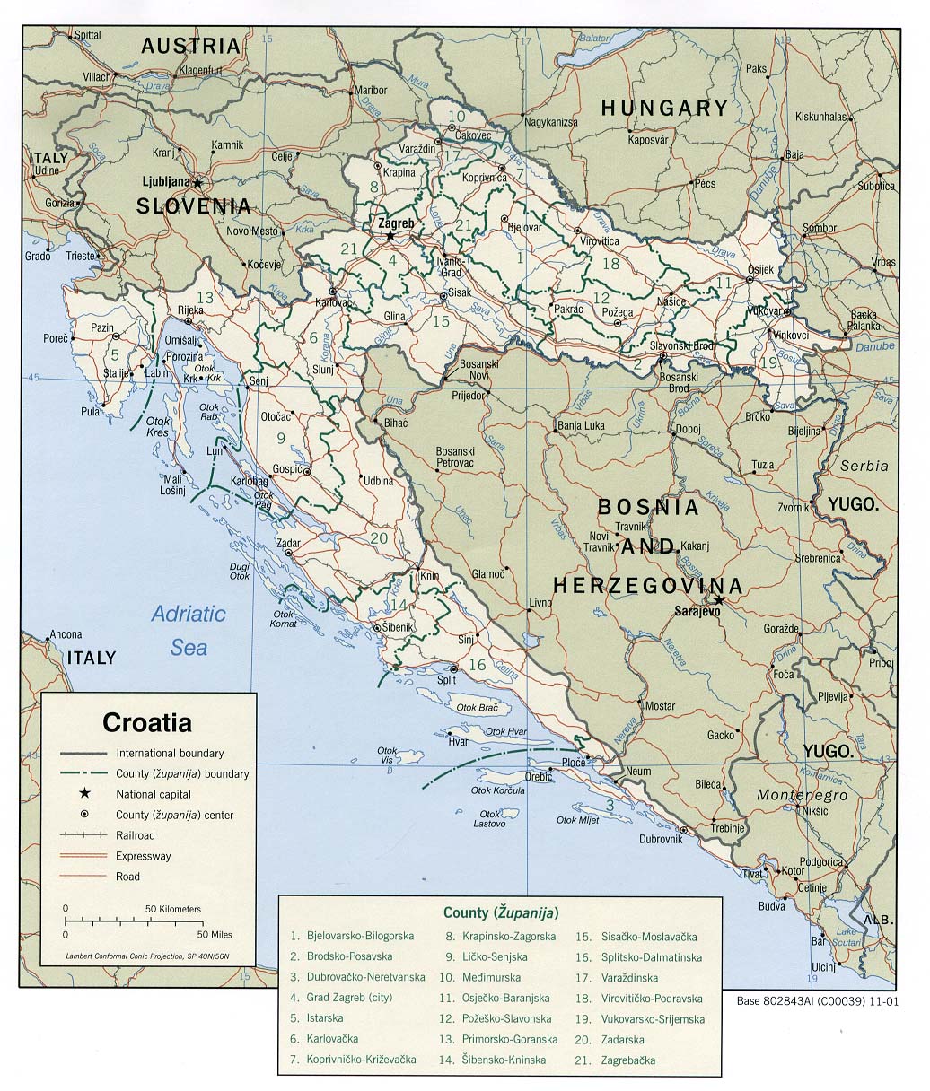
English: Geographical region of Slavonia in Croatia. Region is represented in its wider modern meaning, including Slavonia proper and western (Croatian) part of the region of Syrmia (eastern part of the region of Syrmia that belong to Serbia is not seen as part of Slavonia, but as part of Vojvodina). Western border of Slavonia is represented in accordance with historical borders of two Slavonian counties of the former Kingdom of Croatia-Slavonia. Croatian: Zemljopisna regija Slavonija u Hrvatskoj. Regija je prikazana u svom širem modernom značenju, uključujući užu Slavoniju i zapadni (hrvatski) dio Srijema (istočni dio Srijema koji pripada Srbiji ne smatra se dijelom Slavonije, već dijelom Vojvodine). Zapadna granica Slavonije je prikazana suglasno sa povijesnim granicama dvije slavonske županije negdašnje Hrvatsko-Slavonske Kraljevine. |
| Source | Own work |
| Author | WikiEditor2004 |
| Other versions |
|

Licensing
edit
self made map by WikiEditor2004
| I, the copyright holder of this work, release this work into the public domain. This applies worldwide. In some countries this may not be legally possible; if so: I grant anyone the right to use this work for any purpose, without any conditions, unless such conditions are required by law. |
References
edit
- Peter Rokai - Zoltan Đere - Tibor Pal - Aleksandar Kasaš, Istorija Mađara, Beograd, 2002.
- Školski istorijski atlas, Zavod za izdavanje udžbenika SR Srbije, Beograd, 1970.
- Sve srpske mape - od šestog veka do Pariza, Specijalno izdanje BLICA, Decembar 1995
- File:Croatia-Slavonia.png
- File:Croatia-Slavonia-Kingdom-of-Hungary.png
- http://lib.utexas.edu/maps/europe/croatia_pol01.jpg
File history
Click on a date/time to view the file as it appeared at that time.
| Date/Time | Thumbnail | Dimensions | User | Comment | |
|---|---|---|---|---|---|
| current | 16:26, 10 December 2009 | | 1,431 × 960 (68 KB) | WikiEditor2004 (talk | contribs) | {{Information |Description={{en|1=Geographical region of Slavonia in Croatia}} |Source={{own}} |Author=PANONIAN |Date= |Permission= |other_versions= }} |
You cannot overwrite this file.
File usage on Commons
The following page uses this file:
File usage on other wikis
The following other wikis use this file:
- Usage on an.wikipedia.org
- Usage on be-tarask.wikipedia.org
- Usage on be.wikipedia.org
- Usage on bg.wikipedia.org
- Usage on bs.wikipedia.org
- Usage on ca.wikipedia.org
- Usage on cs.wikipedia.org
- Usage on da.wikipedia.org
- Usage on eo.wikipedia.org
- Usage on es.wikipedia.org
- Usage on fi.wikipedia.org
- Usage on fr.wikipedia.org
- Usage on gl.wikipedia.org
- Usage on id.wikipedia.org
- Usage on it.wikipedia.org
- Usage on la.wikipedia.org
- Usage on lt.wikipedia.org
- Usage on mk.wikipedia.org
- Usage on nl.wikipedia.org
- Usage on no.wikipedia.org
- Usage on pl.wikipedia.org
- Usage on pt.wikipedia.org
- Usage on ro.wikipedia.org
- Usage on ru.wikipedia.org
- Usage on sh.wikipedia.org
- Usage on sk.wikipedia.org
- Usage on sl.wikipedia.org
- Usage on tr.wikipedia.org
- Usage on uk.wikipedia.org