File:Uzbekistan Topography.png
Size of this preview: 800 × 562 pixels. Other resolutions: 320 × 225 pixels | 640 × 449 pixels | 1,024 × 719 pixels | 1,280 × 899 pixels | 2,430 × 1,706 pixels.
Original file (2,430 × 1,706 pixels, file size: 2.86 MB, MIME type: image/png)
Captions
Captions
Add a one-line explanation of what this file represents
Summary
edit
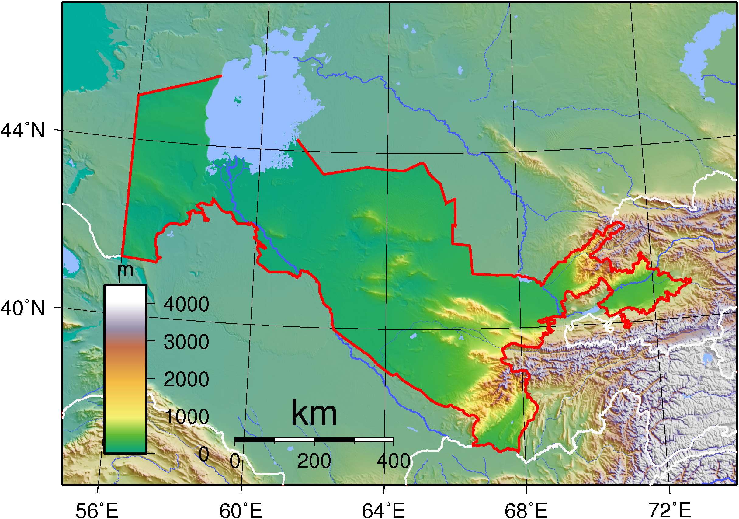
| Description | Topographic map of Uzbekistan. Created with GMT from SRTM data. |
| Date | |
| Source | Own work |
| Author | Sadalmelik |
Licensing
edit
I, the copyright holder of this work, hereby publish it under the following licenses:

|
Permission is granted to copy, distribute and/or modify this document under the terms of the GNU Free Documentation License, Version 1.2 or any later version published by the Free Software Foundation; with no Invariant Sections, no Front-Cover Texts, and no Back-Cover Texts. A copy of the license is included in the section entitled GNU Free Documentation License. |
This file is licensed under the Creative Commons Attribution-Share Alike 3.0 Unported, 2.5 Generic, 2.0 Generic and 1.0 Generic license.
- You are free:
- to share – to copy, distribute and transmit the work
- to remix – to adapt the work
- Under the following conditions:
- attribution – You must give appropriate credit, provide a link to the license, and indicate if changes were made. You may do so in any reasonable manner, but not in any way that suggests the licensor endorses you or your use.
- share alike – If you remix, transform, or build upon the material, you must distribute your contributions under the same or compatible license as the original.
You may select the license of your choice.
File history
Click on a date/time to view the file as it appeared at that time.
| Date/Time | Thumbnail | Dimensions | User | Comment | |
|---|---|---|---|---|---|
| current | 18:06, 1 September 2007 | | 2,430 × 1,706 (2.86 MB) | Sadalmelik (talk | contribs) | {{Information |Description=Topographic map of Uzbekistan. Created with GMT from SRTM data. |Source=self-made |Date=Sep 1, 2007 |Author= Sadalmelik }} Category:Maps of Uzbekistan Category:Topographic maps of Asia |
You cannot overwrite this file.
File usage on Commons
The following page uses this file:
File usage on other wikis
The following other wikis use this file:
- Usage on as.wikipedia.org
- Usage on bn.wikipedia.org
- Usage on ca.wikipedia.org
- Usage on en.wikipedia.org
- Usage on fa.wikipedia.org
- Usage on fr.wikipedia.org
- Usage on hu.wikipedia.org
- Usage on it.wikipedia.org
- Usage on ja.wikipedia.org
- Usage on ka.wikipedia.org
- Usage on pnb.wikipedia.org
- Usage on ru.wikipedia.org
- Ташкент
- Города Узбекистана
- Административное деление Узбекистана
- Айдаркуль
- География Узбекистана
- Проект:Тематическая неделя/Неделя Средней Азии
- Фауна Узбекистана
- Шаблон:География Узбекистана
- Арнасайская система озёр
- Список заповедников Узбекистана
- Проект:Востоковедная неделя/Неделя Узбекистана
- Проект:Востоковедная неделя/II Неделя Узбекистана
- Проект:Тематическая неделя русскоязычных регионов мира/Неделя Узбекистана
- Проект:Тематическая неделя/Узбекистанская неделя
- Реки Узбекистана
- Агалык (горы)
- Проект:Тематическая неделя/II Узбекистанская неделя
- Usage on sl.wikipedia.org
- Usage on sr.wikipedia.org
- Usage on tr.wikipedia.org
- Usage on uk.wikipedia.org
- Usage on ur.wikipedia.org
- Usage on uz.wikipedia.org
- Usage on vep.wikipedia.org
- Usage on zh.wikipedia.org