File:Pechenezhskoe vodochranilishe.jpg
Size of this preview: 327 × 598 pixels. Other resolutions: 131 × 240 pixels | 604 × 1,105 pixels.
Original file (604 × 1,105 pixels, file size: 139 KB, MIME type: image/jpeg)
Captions
Captions
Add a one-line explanation of what this file represents
Summary
edit
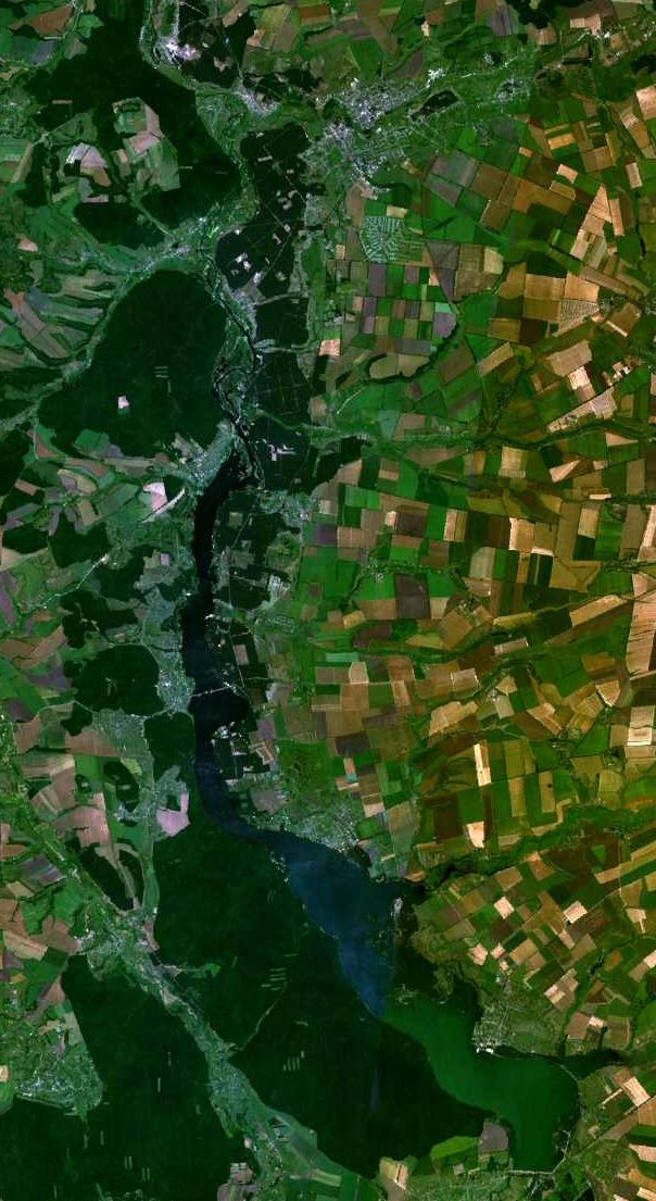
| Description | Pechenezhskoe vodochranilische on Severskii Donetz |
| Date | 27 December 2006 (upload date) |
| Source | Satellite imagery taken from NASA World Wind software (by screenshot) |
| Author | NASA |
Licensing
edit
| This image is in the public domain because it is a screenshot from NASA’s globe software World Wind using a public domain layer, such as Blue Marble, MODIS, Landsat, SRTM, USGS or GLOBE.
|
 |
File history
Click on a date/time to view the file as it appeared at that time.
| Date/Time | Thumbnail | Dimensions | User | Comment | |
|---|---|---|---|---|---|
| current | 03:18, 27 December 2006 | | 604 × 1,105 (139 KB) | Wind (talk | contribs) | {{Information |Description=Pechenezhskoe vodochranilische on Severskii Donetz |Source= |Date= |Author= |Permission={{PD-WorldWind}} |other_versions= }} {{Usage}} Category:Seversky Donets |
You cannot overwrite this file.
File usage on Commons
The following page uses this file:
File usage on other wikis
The following other wikis use this file:
- Usage on ba.wikipedia.org
- Usage on ceb.wikipedia.org
- Usage on ce.wikipedia.org
- Usage on de.wikipedia.org
- Usage on en.wikipedia.org
- Usage on ru.wikipedia.org
- Usage on sl.wikipedia.org
- Usage on uk.wikipedia.org
- Usage on vi.wikipedia.org
- Usage on www.wikidata.org