File:Cyprus districts.svg

Original file (SVG file, nominally 1,060 × 645 pixels, file size: 151 KB)
Captions
Captions
| Description |
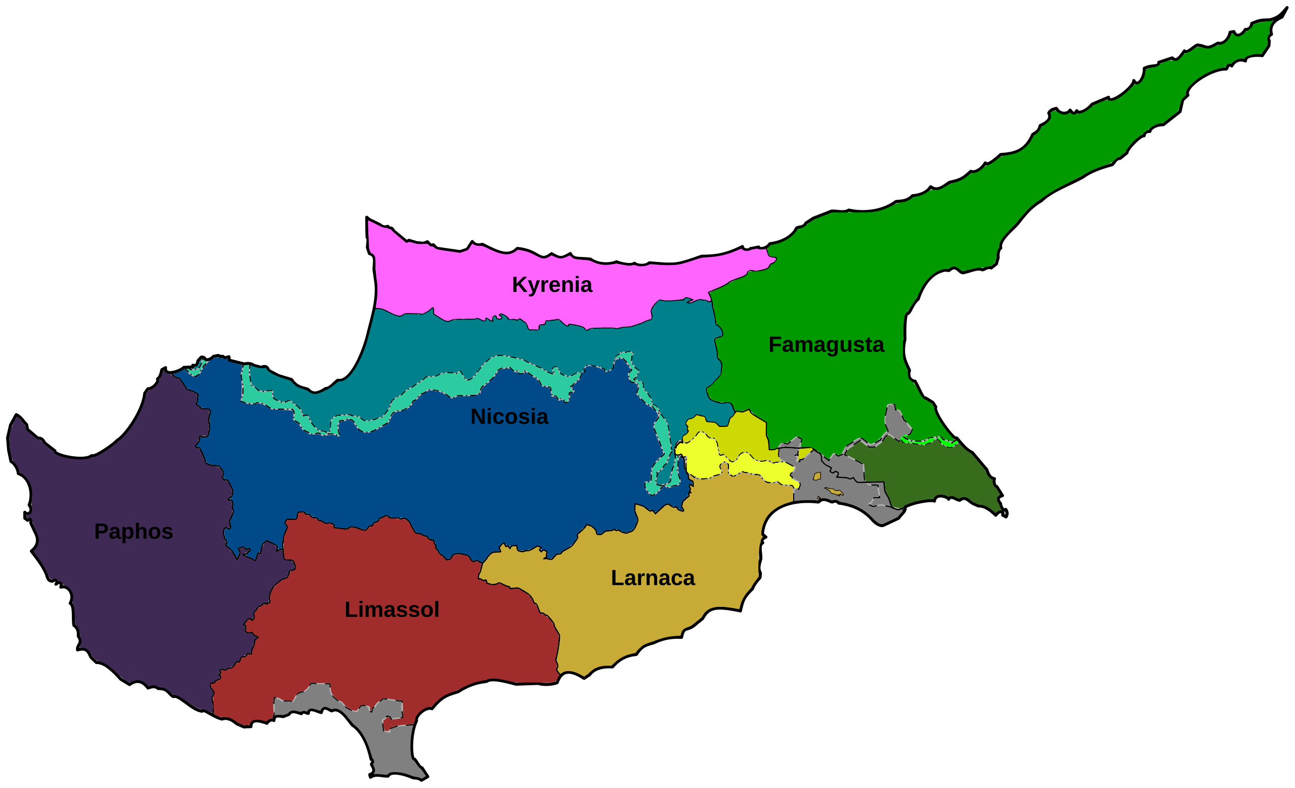
Català: Mapa de Xipre que mostra els districtes
English: Map of Cyprus showing districts |
| Date | (UTC) |
| Source | |
| Author |
|
| Other versions |
File:Cyprus districts.svg has 2 translations.
Other related versions: []
|


- You are free:
- to share – to copy, distribute and transmit the work
- to remix – to adapt the work
- Under the following conditions:
- attribution – You must give appropriate credit, provide a link to the license, and indicate if changes were made. You may do so in any reasonable manner, but not in any way that suggests the licensor endorses you or your use.
| This is a retouched picture, which means that it has been digitally altered from its original version. Modifications: Color corrections, SVG conversion. The original can be viewed here: Cyprus districts.jpg:
|

|
This SVG file contains embedded text that can be translated into your language, using any capable SVG editor, text editor or the SVG Translate tool. For more information see: About translating SVG files. |
This file is translated using SVG <switch> elements. All translations are stored in the same file! Learn more.
For most Wikipedia projects, you can embed the file normally (without a To translate the text into your language, you can use the SVG Translate tool. Alternatively, you can download the file to your computer, add your translations using whatever software you're familiar with, and re-upload it with the same name. You will find help in Graphics Lab if you're not sure how to do this. |
Original upload log
edit
This image is a derivative work of the following images:
- File:Cyprus_districts.jpg licensed with Cc-by-3.0
- 2009-11-02T19:47:57Z NeoCy 8610x5270 (2826077 Bytes) Reverted to version as of 08:37, 5 October 2009
- 2009-11-02T12:14:18Z NeoCy 8610x5270 (2826077 Bytes) better colouring in Buffer Zone and SBAs
- 2009-10-05T08:37:37Z NeoCy 8610x5270 (2826077 Bytes)
- 2009-09-09T07:12:56Z NeoCy 4305x2635 (965733 Bytes) {{Information |Description={{en|1=Map of Cyprus showing districts}} |Source=Own work by uploader |Author=[[User:NeoCy|Alexander-Michael Hadjilyra]] |Date=2009-09-09 |Permission= |other_versions= }}
Uploaded with derivativeFX
File history
Click on a date/time to view the file as it appeared at that time.
| Date/Time | Thumbnail | Dimensions | User | Comment | |
|---|---|---|---|---|---|
| current | 10:00, 16 June 2024 | | 1,060 × 645 (151 KB) | ToprakM (talk | contribs) | File uploaded using svgtranslate tool (https://svgtranslate.toolforge.org/). Added translation for tr. |
| 14:03, 9 February 2024 |  | 1,060 × 645 (151 KB) | Manlleus (talk | contribs) | added catalan language | |
| 18:21, 30 March 2011 |  | 1,060 × 645 (151 KB) | Ufo karadagli (talk | contribs) | British bases colored gray, color of w:Kokkina exclave corrected and code cleaned up. | |
| 16:17, 20 March 2011 |  | 1,060 × 645 (158 KB) | Chipmunkdavis (talk | contribs) | Standardising the difference between the north and south, making the south darker, while highlighting the UN buffer zone. Blanking Akrotiri and Dhekelia. | |
| 11:36, 12 March 2011 |  | 1,060 × 645 (157 KB) | Ufo karadagli (talk | contribs) | {{Information |Description={{en|1=Map of Cyprus showing districts}} |Source=*File:Cyprus_districts.jpg |Date=2011-03-12 11:00 (UTC) |Author=*File:Cyprus_districts.jpg: Alexander-Michael Hadjilyra *derivative work: ~~~ |Permissio |
You cannot overwrite this file.
File usage on Commons
The following 8 pages use this file:
File usage on other wikis
The following other wikis use this file:
- Usage on bn.wikipedia.org
- Usage on ca.wikipedia.org
- Usage on cs.wikipedia.org
- Usage on en.wikipedia.org
- Usage on fa.wikipedia.org
- Usage on hy.wikipedia.org
- Usage on id.wikipedia.org
- Usage on incubator.wikimedia.org
- Usage on is.wikipedia.org
- Usage on ms.wikipedia.org
- Usage on simple.wikipedia.org
- Usage on uk.wikipedia.org
- Usage on ur.wikipedia.org
- Usage on vi.wikipedia.org
- Usage on zh.wikipedia.org