File:Karte Freiburger Alpen.png
Size of this preview: 775 × 600 pixels. Other resolutions: 310 × 240 pixels | 620 × 480 pixels | 992 × 768 pixels | 1,280 × 991 pixels | 2,560 × 1,981 pixels | 4,742 × 3,670 pixels.
Original file (4,742 × 3,670 pixels, file size: 4.52 MB, MIME type: image/png)
Captions
Captions
Add a one-line explanation of what this file represents
Summary
edit
| Description |
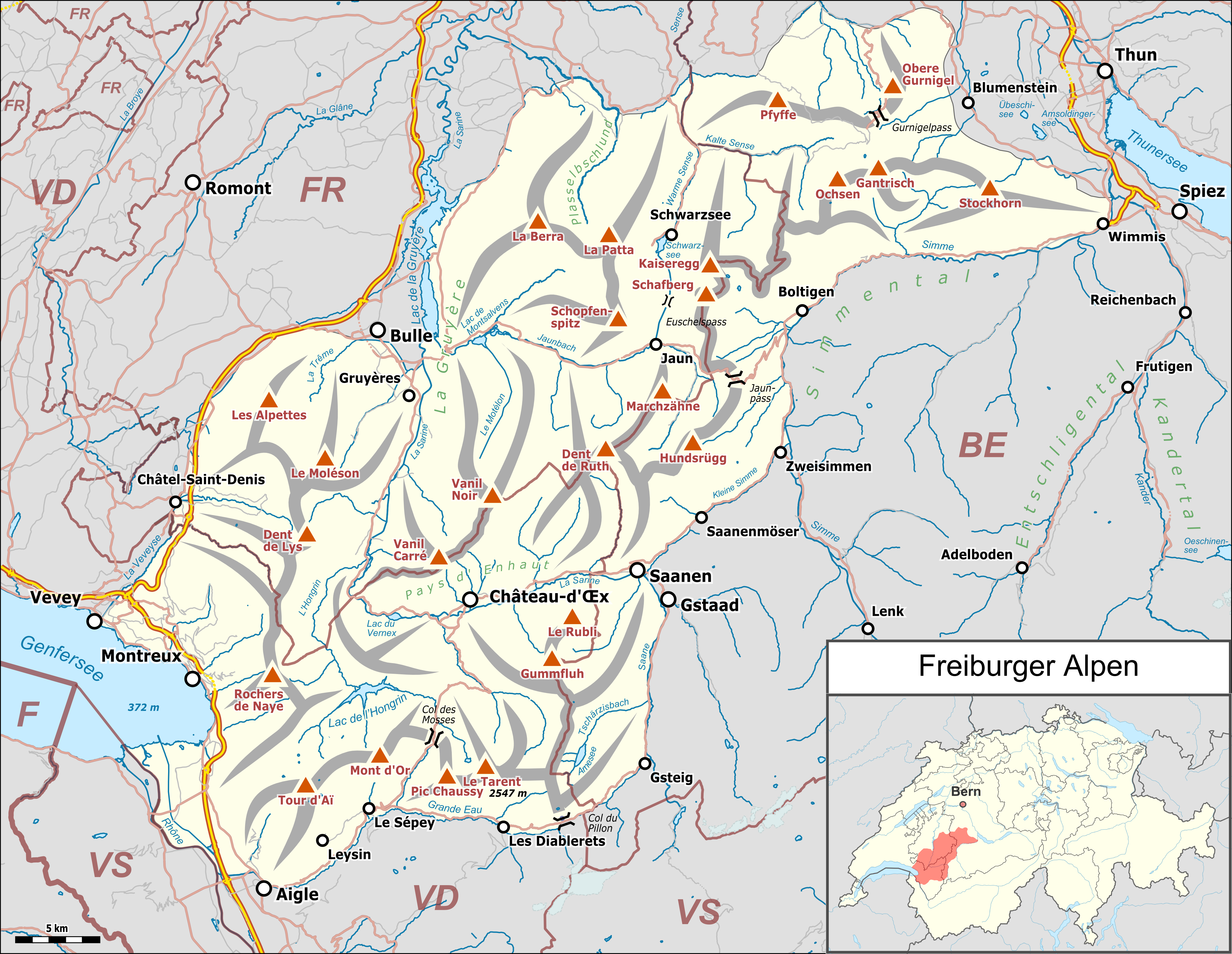
Deutsch: Lagekarte der Waadtländer un Fryburger Voralpe (SOIUSA). |
|||||||||
| Date | ||||||||||
| Source |
Own work Map was created using:
|
|||||||||
| Creator | ||||||||||
| Permission (Reusing this file) |
Map data (c) OpenStreetMap (and) contributors, CC-BY-SA | |||||||||
| Geotemporal data | ||||||||||
| Bounding box |
|
|||||||||
| Georeferencing | ||||||||||
This file is licensed under the Creative Commons Attribution-Share Alike 2.0 Generic license.
- You are free:
- to share – to copy, distribute and transmit the work
- to remix – to adapt the work
- Under the following conditions:
- attribution – You must give appropriate credit, provide a link to the license, and indicate if changes were made. You may do so in any reasonable manner, but not in any way that suggests the licensor endorses you or your use.
- share alike – If you remix, transform, or build upon the material, you must distribute your contributions under the same or compatible license as the original.
File history
Click on a date/time to view the file as it appeared at that time.
| Date/Time | Thumbnail | Dimensions | User | Comment | |
|---|---|---|---|---|---|
| current | 14:09, 3 January 2019 | | 4,742 × 3,670 (4.52 MB) | Pechristener (talk | contribs) | error in height fixed, resolution improved |
| 14:00, 3 January 2019 |  | 1,277 × 988 (896 KB) | Pechristener (talk | contribs) | highest point is not Vanil Noir but Le Tarent | |
| 20:06, 30 December 2018 |  | 1,277 × 988 (896 KB) | Pechristener (talk | contribs) | == {{int:filedesc}} == {{map |Description={{de|1=Lagekarte der Freiburger Alpen}} |Source ={{own}} Map was created using: *[http://www.openstreetmap.org/ Open Street Map] *Switzerland location map.svg for location map |Author = *Pechristener *File:Switzerland location map.svg: NordNordWest |Date =2018-12-30 |Permission =Map data (c) OpenSt... |
You cannot overwrite this file.
File usage on Commons
The following page uses this file:
File usage on other wikis
The following other wikis use this file:
- Usage on als.wikipedia.org
- Usage on arz.wikipedia.org
- Usage on de.wikipedia.org
- Usage on nl.wikipedia.org
- Usage on www.wikidata.org