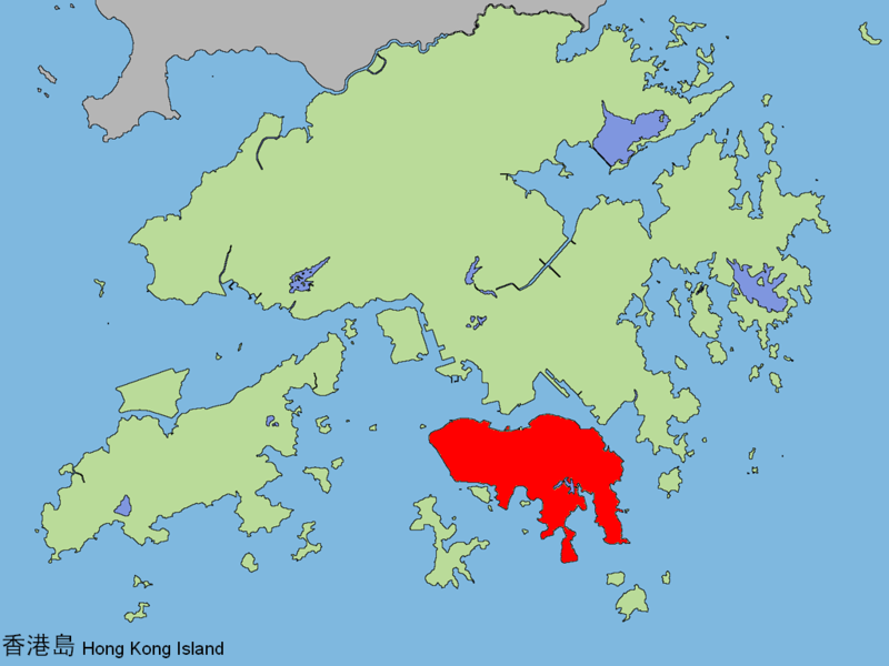
File:Hongkongisland.png

Size of this preview: 800 × 600 pixels. Other resolutions: 320 × 240 pixels | 640 × 480 pixels | 1,024 × 768 pixels.
Original file (1,024 × 768 pixels, file size: 207 KB, MIME type: image/png)
File information
Structured data
Captions
Captions
Add a one-line explanation of what this file represents
Summary
edit| DescriptionHongkongisland.png |
English: Location of HK Island in Hong Kong 中文(香港):香港島位置。 |
||
| Date | |||
| Source | zh:Image:Hongkongisland.png | ||
| Author |
|
Licensing
editThis file is licensed under the Creative Commons Attribution 2.0 Generic license.
- You are free:
- to share – to copy, distribute and transmit the work
- to remix – to adapt the work
- Under the following conditions:
- attribution – You must give appropriate credit, provide a link to the license, and indicate if changes were made. You may do so in any reasonable manner, but not in any way that suggests the licensor endorses you or your use.
File history
Click on a date/time to view the file as it appeared at that time.
| Date/Time | Thumbnail | Dimensions | User | Comment | |
|---|---|---|---|---|---|
| current | 21:02, 26 May 2006 |  | 1,024 × 768 (207 KB) | HKFumi (talk | contribs) | {{Information |Description=Location of HK Island in Hong Kong |Source=zh:Image:Hongkongisland.png |Date=2006-04-16 |Author=zh:User:Iflwlou |Permission={{cc-by-2.0}} |other_versions= }} |
You cannot overwrite this file.
File usage on Commons
The following 2 pages use this file:
File usage on other wikis
The following other wikis use this file:
- Usage on be.wikipedia.org
- Usage on cs.wikipedia.org
- Usage on en.wikipedia.org
- A Kung Ngam
- Tai Tam Road
- East Point, Hong Kong
- Mount Parker (Hong Kong)
- Chater Garden
- Government Hill
- Wah Fu
- Cape D'Aguilar
- Sandy Bay, Hong Kong
- Pok Fu Lam Road
- So Kon Po
- Aldrich Bay
- Cape Collinson
- Pottinger Street
- Garden Road, Hong Kong
- Sulphur Channel
- Ap Lei Pai
- Mount Gough
- Pok Fu Lam Reservoir
- Morrison Hill
- Kellett Bay
- Wong Nai Chung Gap
- Whitty Street
- Rumsey Street
- Belcher Bay
- Fortress Hill
- High West
- Gough Street
- Sugar Street (Hong Kong)
- Old Stanley Police Station
- Tin Hau, Hong Kong
- Mount Nicholson
- Chung Hom Kok
- Tai Tam Country Park
- Aberdeen Country Park
- Pok Fu Lam Country Park
- Shek O Country Park
- Aberdeen Promenade
- Blake Garden, Hong Kong
- Cheung Kong Park
- Mount Butler
- Water Street, Hong Kong
- Jaffe Road
- The Peak Galleria
- Tin Hau Temple Road
- Dragon's Back
- Middle Island, Hong Kong
- D'Aguilar Peninsula
View more global usage of this file.