File:Sunzha Line.png
Size of this preview: 800 × 404 pixels. Other resolutions: 320 × 162 pixels | 640 × 323 pixels | 1,024 × 518 pixels | 1,848 × 934 pixels.
Original file (1,848 × 934 pixels, file size: 3 MB, MIME type: image/png)
Captions
Captions
Add a one-line explanation of what this file represents
Summary
edit
| Description |
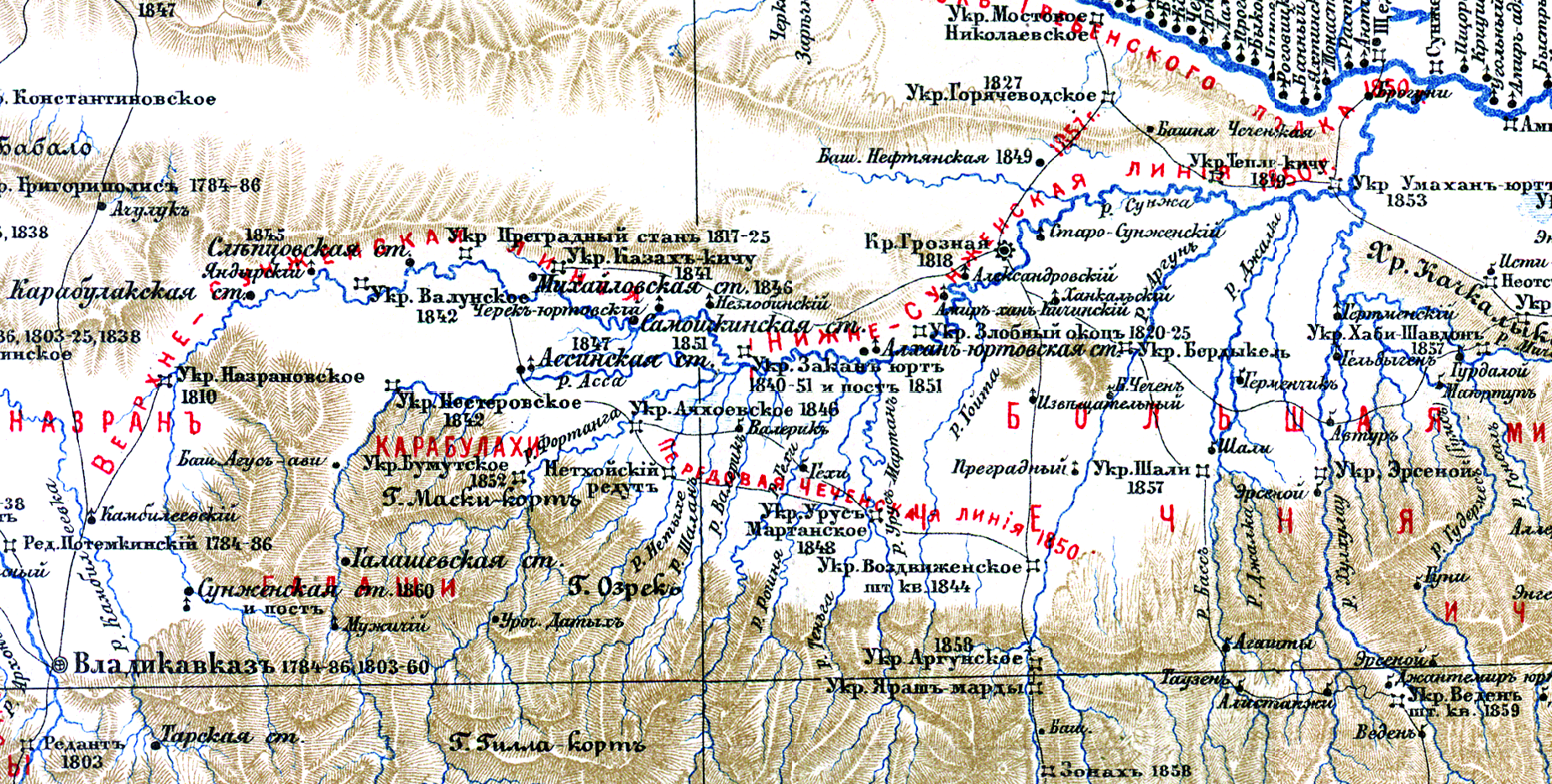
Русский: Карта Сунженской линии |
| Date | |
| Source | Фелицын Е. Д. Военно-историческая карта северо-восточного Кавказа. — Масштаб: в 1 англ. дюйме 20 вёрст. — Тифлис, 1899. — (опубликована в книге «Исторический очерк кавказских войн от их начала до присоединения Грузии») |
| Author | Фелицын Е. Д. Военно-историческая карта северо-восточного Кавказа. — Масштаб: в 1 англ. дюйме 20 вёрст. — Тифлис, 1899. — (опубликована в книге «Исторический очерк кавказских войн от их начала до присоединения Грузии») |
Licensing
edit
|
This work is in the public domain in its country of origin and other countries and areas where the copyright term is the author's life plus 70 years or fewer. This work is in the public domain in the United States because it was published (or registered with the U.S. Copyright Office) before January 1, 1929. | |
| This file has been identified as being free of known restrictions under copyright law, including all related and neighboring rights. | |
File history
Click on a date/time to view the file as it appeared at that time.
| Date/Time | Thumbnail | Dimensions | User | Comment | |
|---|---|---|---|---|---|
| current | 12:42, 16 December 2016 | | 1,848 × 934 (3 MB) | Simba16 (talk | contribs) | User created page with UploadWizard |
You cannot overwrite this file.
File usage on Commons
There are no pages that use this file.
File usage on other wikis
The following other wikis use this file:
- Usage on ru.wikipedia.org
- Usage on uk.wikipedia.org