File:Scotora2 PJC.jpg
Size of this preview: 800 × 533 pixels. Other resolutions: 320 × 213 pixels | 640 × 427 pixels | 1,024 × 683 pixels | 1,280 × 853 pixels | 2,560 × 1,707 pixels | 3,888 × 2,592 pixels.
Original file (3,888 × 2,592 pixels, file size: 5.56 MB, MIME type: image/jpeg)
Captions
Captions
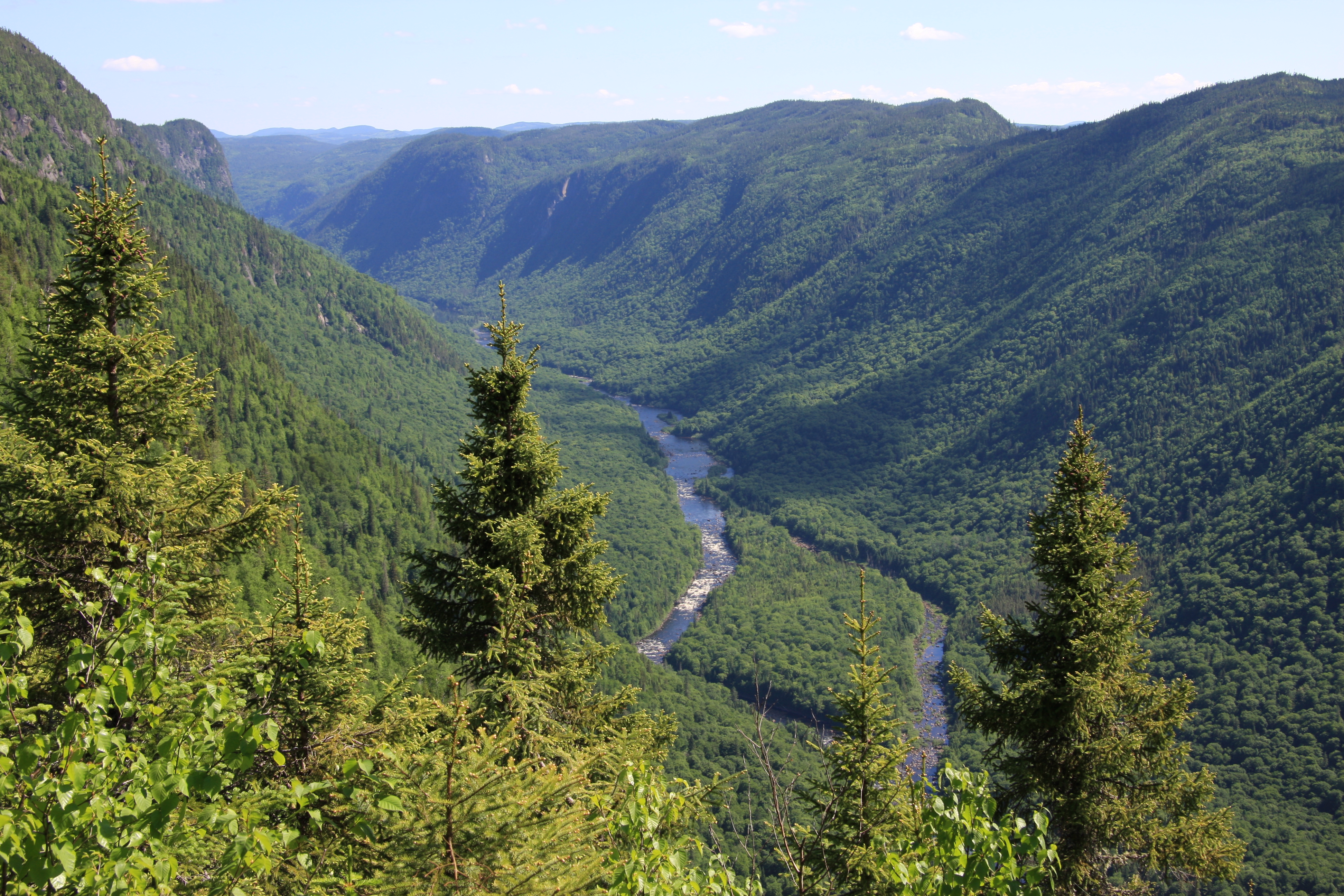
Jacques-Cartier River valley, Jacques-Cartier National Park, Quebec, Canada
Summary
edit
| Description |
English: Scenic view of Jacques-Cartier River valley from Andante montain, Jacques-Cartier National Park, Quebec, Canada
Français : Vue panoramique de la vallée de la Rivière Jacques-Cartier du sommet du Mont Andante, Parc national de la Jacques-Cartier, Québec, Canada |
| Date | |
| Source | Own work |
| Author | Cephas |
| Camera location | | View this and other nearby images on: OpenStreetMap |
|---|
Licensing
edit
I, the copyright holder of this work, hereby publish it under the following licenses:

|
Permission is granted to copy, distribute and/or modify this document under the terms of the GNU Free Documentation License, Version 1.2 or any later version published by the Free Software Foundation; with no Invariant Sections, no Front-Cover Texts, and no Back-Cover Texts. A copy of the license is included in the section entitled GNU Free Documentation License. |
This file is licensed under the Creative Commons Attribution-Share Alike 3.0 Unported, 2.5 Generic, 2.0 Generic and 1.0 Generic license.
- You are free:
- to share – to copy, distribute and transmit the work
- to remix – to adapt the work
- Under the following conditions:
- attribution – You must give appropriate credit, provide a link to the license, and indicate if changes were made. You may do so in any reasonable manner, but not in any way that suggests the licensor endorses you or your use.
- share alike – If you remix, transform, or build upon the material, you must distribute your contributions under the same or compatible license as the original.
You may select the license of your choice.
This image has been assessed using the Quality image guidelines and is considered a Quality image.
|
File history
Click on a date/time to view the file as it appeared at that time.
| Date/Time | Thumbnail | Dimensions | User | Comment | |
|---|---|---|---|---|---|
| current | 22:50, 24 June 2009 | | 3,888 × 2,592 (5.56 MB) | Cephas (talk | contribs) | {{Information |Description={{en|1=Scenic view of Jacques-Cartier River valley from Andante montain, Jacques-Cartier National Park, Quebec, Canada}} {{fr|1=Vue panoramique de la vallée de |
You cannot overwrite this file.
File usage on Commons
The following 8 pages use this file:
- User:Cephas
- User:Cephas/Archives 2009-2011
- Commons:Featured picture candidates/File:Scotora2 PJC.jpg
- Commons:Featured picture candidates/Log/August 2009
- Commons:Quality images/Subject/Places/Natural structures/archive 2008 to 2012
- Commons:Quality images candidates/Archives August 2009
- Category:Eastern forest–boreal transition
- Category:Parc national de la Jacques-Cartier
File usage on other wikis
The following other wikis use this file:
- Usage on ca.wikimedia.org
- Usage on de.wikipedia.org
- Usage on en.wikipedia.org
- Usage on en.wikivoyage.org
- Usage on es.wikipedia.org
- Usage on fr.wikipedia.org
- Parcs nationaux du Québec
- Portail:Ville de Québec/Lumière sur/Archives
- Projet:Impression/Quality images/112
- Portail:Ville de Québec/Lumière
- Portail:Ville de Québec/Lumière/31
- Sentier des Jésuites
- Liste des parcs nationaux des Laurentides
- Utilisateur:YanikB/Tableau wikidata
- Utilisateur:Exp JC/Brouillon
- Usage on fr.wikivoyage.org
- Parc national de la Jacques-Cartier
- Réserve faunique des Laurentides
- Château-Richer
- Lac-Beauport
- Sainte-Brigitte-de-Laval
- Stoneham-et-Tewkesbury
- Saint-Gabriel-de-Valcartier
- Shannon (Québec)
- Fossambault-sur-le-Lac
- Lac-Saint-Joseph
- Sainte-Catherine-de-la-Jacques-Cartier
- Lac-Delage
- Lac-Croche
- Lac-Jacques-Cartier
- Usage on fy.wikipedia.org
- Usage on he.wikipedia.org
- Usage on lad.wikipedia.org
- Usage on mk.wikipedia.org
- Usage on nl.wikipedia.org
- Usage on pt.wikipedia.org
- Usage on ru.wikipedia.org
- Usage on sk.wikipedia.org
- Usage on sr.wikipedia.org
- Usage on uk.wikipedia.org
- Usage on vls.wikipedia.org
View more global usage of this file.