File:Wehra.jpg
Size of this preview: 450 × 600 pixels. Other resolutions: 180 × 240 pixels | 600 × 800 pixels.
Original file (600 × 800 pixels, file size: 212 KB, MIME type: image/jpeg)
Captions
Captions
Add a one-line explanation of what this file represents
Summary
edit
| Description |
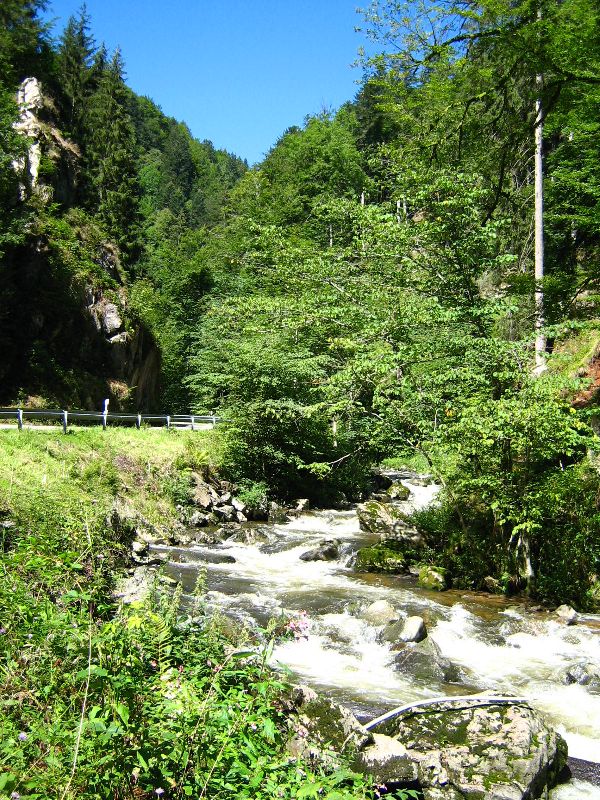
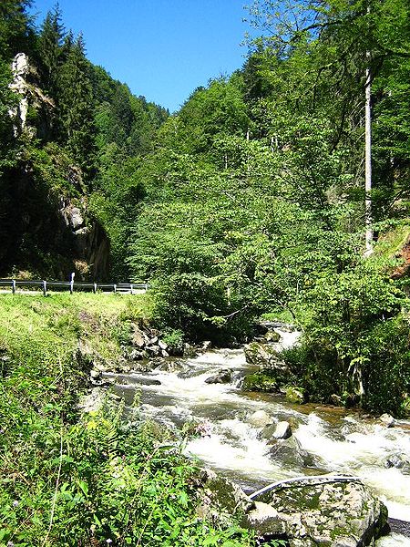
Deutsch: Die Wehra, im Bereich des Gewannes Schanze, etwa auf halber Länge des Flussverlaufes. |
| Date | |
| Source | Self-photographed |
| Author | G. Boll Waldshut (G-Boll) |
Licensing
edit
G-Boll, the copyright holder of this work, hereby publishes it under the following license:

|
Permission is granted to copy, distribute and/or modify this document under the terms of the GNU Free Documentation License, Version 1.2 or any later version published by the Free Software Foundation; with no Invariant Sections, no Front-Cover Texts, and no Back-Cover Texts. A copy of the license is included in the section entitled GNU Free Documentation License. |
| This file is licensed under the Creative Commons Attribution-Share Alike 3.0 Unported license. | ||
| Attribution: G-Boll | ||
| ||
| This licensing tag was added to this file as part of the GFDL licensing update. |
Original upload log
edit
Transferred from de.wikipedia to Commons.
The original description page was here. All following user names refer to de.wikipedia.
- 2006-08-26 18:56 G-Boll 600×800 (216894 bytes) Die Wehra, im Bereich des Gewannes ''Schanze'', etwa auf halber Länge des Flussverlaufes. Aufnahme vom 18.08.2006 Foto: G. Boll Waldshut.
File history
Click on a date/time to view the file as it appeared at that time.
| Date/Time | Thumbnail | Dimensions | User | Comment | |
|---|---|---|---|---|---|
| current | 18:32, 11 June 2007 | | 600 × 800 (212 KB) | Frokor (talk | contribs) | {{Information |Description=Die Wehra, im Bereich des Gewannes ''Schanze'', etwa auf halber Länge des Flussverlaufes. Aufnahme vom 18.08.2006 Foto: G. Boll Waldshut. |Source=Originally from [http://de.wikipedia.org de.wikipedia]; description page is/wa |
You cannot overwrite this file.
File usage on Commons
The following 3 pages use this file:
File usage on other wikis
The following other wikis use this file:
- Usage on als.wikipedia.org
- Usage on ceb.wikipedia.org
- Usage on cv.wikipedia.org
- Usage on da.wikipedia.org
- Usage on de.wikipedia.org
- Schluchtensteig
- Benutzer:Anarabert/Liste der Fließgewässer im Flusssystem Rhein
- Liste der Bannwälder in Baden-Württemberg
- Liste der Landschaftsschutzgebiete im Landkreis Lörrach
- Liste der Landschaftsschutzgebiete im Landkreis Waldshut
- Benutzer:Derzno/Landschaftsschutzgebiete in Baden-Württemberg
- Benutzer:Derzno/Naturwaldreservate in Baden-Württemberg
- Benutzer:Triplec85/DE-BW
- Usage on de.wikivoyage.org
- Usage on en.wikipedia.org
- Usage on nn.wikipedia.org
- Usage on no.wikipedia.org
- Usage on ru.wikipedia.org
- Usage on www.wikidata.org
- Usage on zh.wikipedia.org