File:Rhodesialand.png
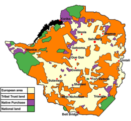
Size of this preview: 651 × 600 pixels. Other resolutions: 261 × 240 pixels | 521 × 480 pixels | 700 × 645 pixels.
Original file (700 × 645 pixels, file size: 135 KB, MIME type: image/png)
Captions
Captions
Add a one-line explanation of what this file represents
Summary
edit

|
This historical map image could be re-created using vector graphics as an SVG file. This has several advantages; see Commons:Media for cleanup for more information. If an SVG form of this image is available, please upload it and afterwards replace this template with
{{vector version available|new image name}}.
It is recommended to name the SVG file “Rhodesialand.svg”—then the template Vector version available (or Vva) does not need the new image name parameter. |

|
This map has been uploaded by Electionworld from en.wikipedia.org to enable the |
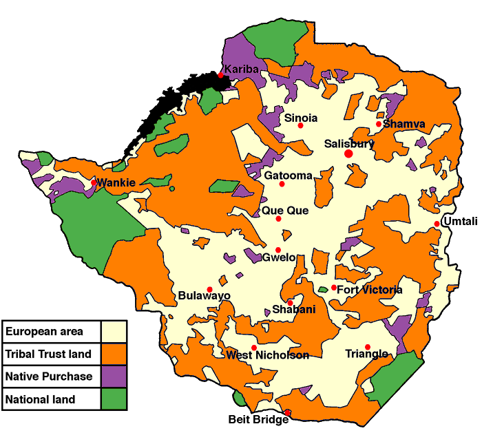
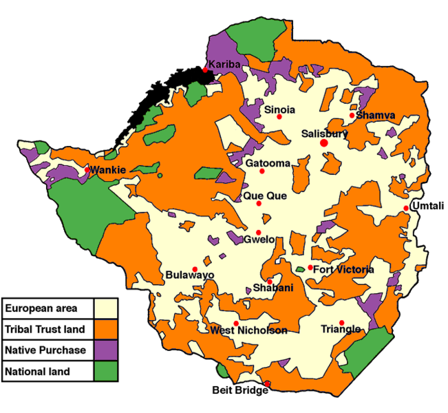
Land apportionment in Rhodesia, 1965. Adapted from a map in 'Rhodesia and Independence' by Kenneth Young (Eyre and Spottiswoode, London, 1967).
Licensing
edit
I, the copyright holder of this work, hereby publish it under the following licenses:

|
Permission is granted to copy, distribute and/or modify this document under the terms of the GNU Free Documentation License, Version 1.2 or any later version published by the Free Software Foundation; with no Invariant Sections, no Front-Cover Texts, and no Back-Cover Texts. A copy of the license is included in the section entitled GNU Free Documentation License. |
| This file is licensed under the Creative Commons Attribution-Share Alike 3.0 Unported license. | ||
| ||
| This licensing tag was added to this file as part of the GFDL licensing update. |
You may select the license of your choice.
derivative works
edit
Derivative works of this file: Rhodesialand Arabic.png
File history
Click on a date/time to view the file as it appeared at that time.
| Date/Time | Thumbnail | Dimensions | User | Comment | |
|---|---|---|---|---|---|
| current | 20:20, 18 April 2020 | | 700 × 645 (135 KB) | Yue (talk | contribs) | Transparent background. |
| 01:35, 28 November 2016 |  | 699 × 747 (158 KB) | Hohum (talk | contribs) | Colours per w:WP:WikiProject Maps/Conventions | |
| 00:44, 13 December 2006 |  | 699 × 747 (162 KB) | Fys (talk | contribs) | Reuploaded because of fault with original. | |
| 22:04, 11 December 2006 |  | 699 × 747 (171 KB) | Electionworld (talk | contribs) | {{ew|en|Fys}} Land apportionment in Rhodesia, 1965. Adapted from a map in 'Rhodesia and Independence' by Kenneth Young (Eyre and Spottiswoode, London, 1967). == Licensing == {{GFDL-self}} Category:Maps of the history of Zimbabwe |
You cannot overwrite this file.
File usage on Commons
The following 3 pages use this file:
File usage on other wikis
The following other wikis use this file:
- Usage on als.wikipedia.org
- Usage on ar.wikipedia.org
- Usage on arz.wikipedia.org
- Usage on bg.wikipedia.org
- Usage on bn.wikipedia.org
- Usage on ca.wikipedia.org
- Usage on cy.wikipedia.org
- Usage on de.wikipedia.org
- Usage on en.wikipedia.org
- Usage on en.wikibooks.org
- Usage on eo.wikipedia.org
- Usage on fr.wikipedia.org
- Usage on gl.wikipedia.org
- Usage on lt.wikipedia.org
- Usage on no.wikipedia.org
- Usage on ro.wikipedia.org
- Usage on sw.wikipedia.org
- Usage on www.wikidata.org
- Usage on zh.wikipedia.org