File:Karte Expedition William Dampier 1699.png

Size of this preview: 800 × 555 pixels. Other resolutions: 320 × 222 pixels | 640 × 444 pixels | 1,024 × 711 pixels | 1,200 × 833 pixels.
Original file (1,200 × 833 pixels, file size: 1.11 MB, MIME type: image/png)
Captions
Captions
Add a one-line explanation of what this file represents
Summary
edit
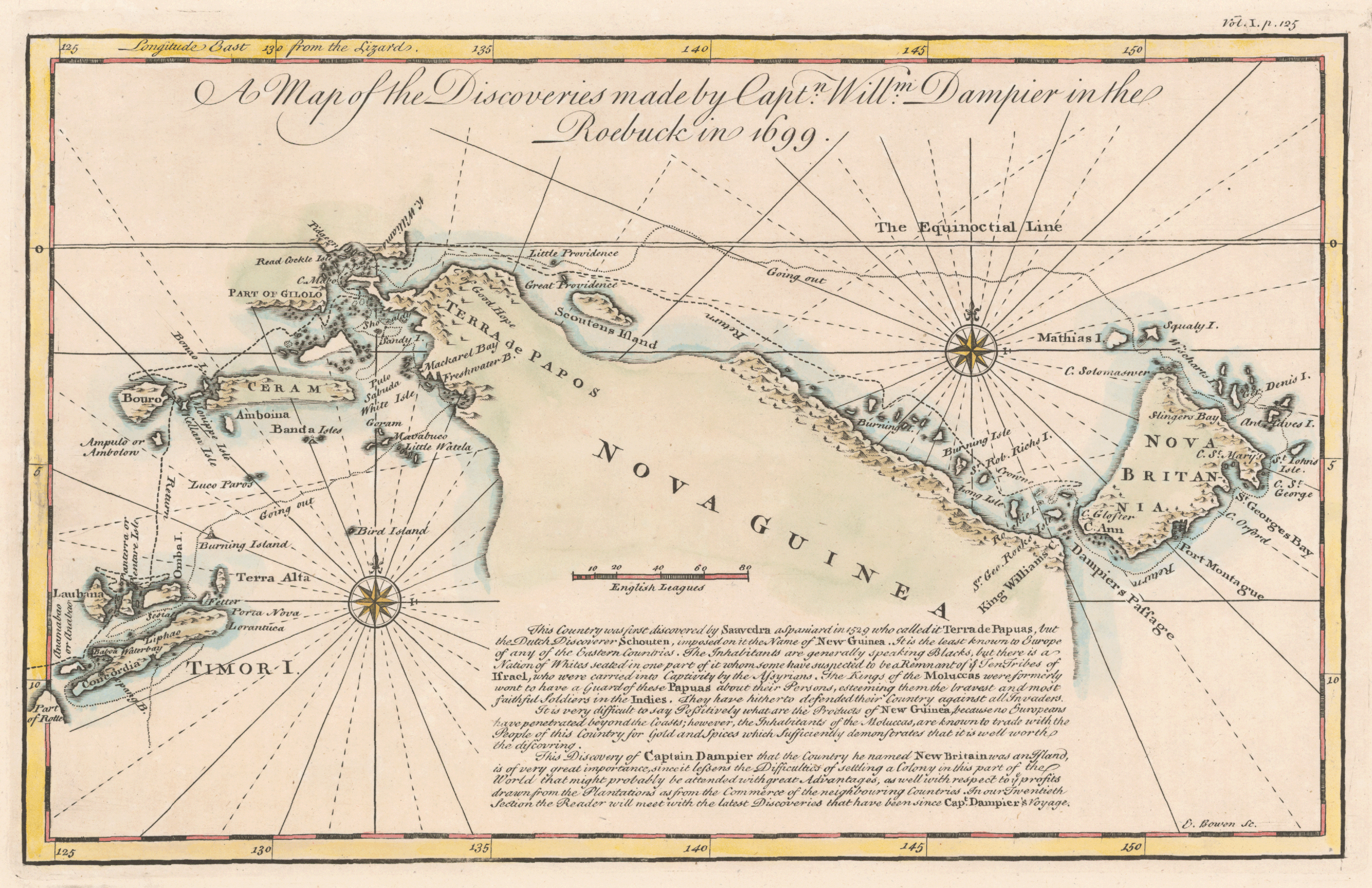
| Description | Karte der Route der Expedition von William Dampier entlang der West-/Nordwestküste Australiens, sowie der Küsten Timors, Neuguineas und Neubritanniens 1699 |
| Date | |
| Source |
"own work", used: |
| Author | Lencer |

|
This map has been made or improved in the German Kartenwerkstatt (Map Lab). You can propose maps to improve as well.
|
Licensing
edit
This file is licensed under the Creative Commons Attribution-Share Alike 3.0 Unported license.
- You are free:
- to share – to copy, distribute and transmit the work
- to remix – to adapt the work
- Under the following conditions:
- attribution – You must give appropriate credit, provide a link to the license, and indicate if changes were made. You may do so in any reasonable manner, but not in any way that suggests the licensor endorses you or your use.
- share alike – If you remix, transform, or build upon the material, you must distribute your contributions under the same or compatible license as the original.
File history
Click on a date/time to view the file as it appeared at that time.
| Date/Time | Thumbnail | Dimensions | User | Comment | |
|---|---|---|---|---|---|
| current | 11:11, 12 October 2010 | | 1,200 × 833 (1.11 MB) | Lencer (talk | contribs) | some fixes |
| 11:25, 1 October 2010 |  | 1,200 × 796 (1.07 MB) | Lencer (talk | contribs) | {{Information |Description= Karte der Route der Expedition von William Dampier entlang der West-/Nordwestküste Australiens, sowie der Küsten Timors, Neuguineas und Neubritanniens 1699 |Source="own work", used: * [[:File:Australia |
You cannot overwrite this file.
File usage on Commons
There are no pages that use this file.
File usage on other wikis
The following other wikis use this file:
- Usage on als.wikipedia.org
- Usage on de.wikipedia.org
- Usage on en.wikipedia.org
- Usage on lt.wikipedia.org