File:Alsace topo.png
Size of this preview: 412 × 600 pixels. Other resolutions: 165 × 240 pixels | 329 × 480 pixels | 527 × 768 pixels | 703 × 1,024 pixels | 1,475 × 2,148 pixels.
Original file (1,475 × 2,148 pixels, file size: 5.37 MB, MIME type: image/png)
Captions
Captions
Add a one-line explanation of what this file represents

|
This map image could be re-created using vector graphics as an SVG file. This has several advantages; see Commons:Media for cleanup for more information. If an SVG form of this image is available, please upload it and afterwards replace this template with
{{vector version available|new image name}}.
It is recommended to name the SVG file “Alsace topo.svg”—then the template Vector version available (or Vva) does not need the new image name parameter. |
Summary
edit| Description |
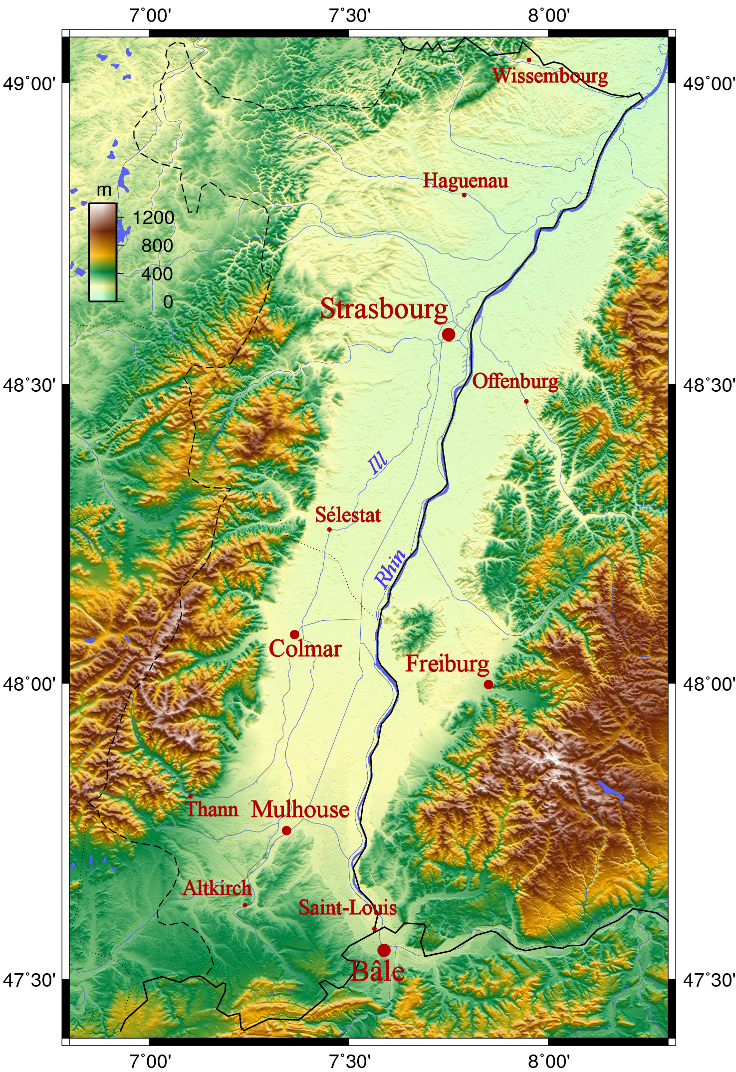
Français : Carte topographique de l'Alsace et de la plaine d'effondrement rhénane. |
| Date | uploaded 14 November 2005 |
| Source |
Self-published work by Neuceu Générée avec GMT et des données issues du SRTM (précision de 90m) |
| Author | Generated by GMT; Uploaded by: Neuceu |
| Other versions |

Licensing
edit
The map has been created with the Generic Mapping Tools: https://www.generic-mapping-tools.org/ using one or more of these public-domain datasets for the relief:
|

|
Permission is granted to copy, distribute and/or modify this document under the terms of the GNU Free Documentation License, Version 1.2 or any later version published by the Free Software Foundation; with no Invariant Sections, no Front-Cover Texts, and no Back-Cover Texts. A copy of the license is included in the section entitled GNU Free Documentation License. |
| This file is licensed under the Creative Commons Attribution-Share Alike 3.0 Unported license. | ||
| ||
| This licensing tag was added to this file as part of the GFDL licensing update. |
Uploader also put {{self|cc-by-sa-2.5}} here - but apparently only the above template is valid for GMT.
File history
Click on a date/time to view the file as it appeared at that time.
| Date/Time | Thumbnail | Dimensions | User | Comment | |
|---|---|---|---|---|---|
| current | 17:54, 15 November 2005 | | 1,475 × 2,148 (5.37 MB) | Neuceu (talk | contribs) | |
| 19:03, 14 November 2005 |  | 1,485 × 2,053 (4.53 MB) | Neuceu (talk | contribs) | Carte topographique de l'Alsace et de la plaine d'effondrement rhénane. Générée avec GMT et des données issues du SRTM (précision de 90m) Category:Alsace Category:Category:Administrative regions of France |
You cannot overwrite this file.
File usage on Commons
The following 2 pages use this file:
File usage on other wikis
The following other wikis use this file:
- Usage on als.wikipedia.org
- Usage on cv.wikipedia.org
- Usage on da.wikipedia.org
- Usage on de.wikipedia.org
- Usage on en.wikipedia.org
- Usage on es.wikipedia.org
- Usage on fr.wikipedia.org
- Usage on ja.wikipedia.org
- Usage on kk.wikipedia.org
- Usage on ku.wikipedia.org
- Usage on pl.wikipedia.org
- Usage on pl.wiktionary.org
- Usage on ru.wikipedia.org
- Usage on sl.wikipedia.org