File:Uk-map-de.png
Size of this preview: 276 × 598 pixels. Other resolution: 312 × 676 pixels.
Original file (312 × 676 pixels, file size: 27 KB, MIME type: image/png)
Captions
Captions
Add a one-line explanation of what this file represents
| Description |
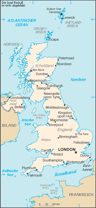
Deutsch: Karte von Großbritannien
English: Map of the United Kingdom (in German) |
|||
| Date | ||||
| Source | Image:Uk-map.png | |||
| Author |
CIA Factbook translated by Head |
|||
| Permission (Reusing this file) |
|

File history
Click on a date/time to view the file as it appeared at that time.
| Date/Time | Thumbnail | Dimensions | User | Comment | |
|---|---|---|---|---|---|
| current | 12:24, 11 December 2007 | | 312 × 676 (27 KB) | Lencer (talk | contribs) | Isle of Man, Guernsey und Jersey als Bestandteil des Vereinigten Königreiches hell eingefärbt. |
| 19:16, 17 May 2006 |  | 312 × 676 (24 KB) | Frumpy (talk | contribs) | Karte von Großbritannien source: Image:Uk-map.png, translated by de:Benutzer:Head ==License== {{PD-USGov-CIA-WF}} |
You cannot overwrite this file.
File usage on Commons
There are no pages that use this file.
File usage on other wikis
The following other wikis use this file:
- Usage on als.wikipedia.org
- Usage on cs.wikipedia.org
- Usage on da.wikipedia.org
- Usage on de.wikipedia.org
- Usage on de.wikibooks.org
- Usage on ksh.wikipedia.org
- Usage on nn.wikipedia.org
- Usage on qu.wikipedia.org
- Usage on sk.wikipedia.org