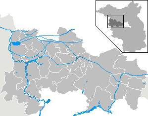
File:Municipalities in HVL.png
Municipalities_in_HVL.png (299 × 235 pixels, file size: 4 KB, MIME type: image/png)
File information
Structured data
Captions
Captions
Add a one-line explanation of what this file represents
| DescriptionMunicipalities in HVL.png |
|
||||||||||||||||||
| Date | |||||||||||||||||||
| Source | Own work | ||||||||||||||||||
| Author | Hagar66 based on work of Geograv | ||||||||||||||||||
| Permission (Reusing this file) |
|
File history
Click on a date/time to view the file as it appeared at that time.
| Date/Time | Thumbnail | Dimensions | User | Comment | |
|---|---|---|---|---|---|
| current | 12:54, 20 May 2010 |  | 299 × 235 (4 KB) | WiebkeCBo (talk | contribs) | {{Information |Description= {{DeLocMaps |mun= |munlink= |lk=Landkreis Havelland |enlk=Havelland |enlklink= |frlk=L'arrondissement du Pays de la Havel |frlklink=Arrondissement du Pays de la Havel |land=Brandenburg |frland=Brandebourg |enland=Brandenburg }} |
You cannot overwrite this file.
File usage on Commons
There are no pages that use this file.
File usage on other wikis
The following other wikis use this file:
- Usage on da.wikipedia.org
- Usage on de.wikipedia.org
- Usage on en.wikipedia.org
- Usage on es.wikipedia.org
- Usage on hsb.wikipedia.org
- Usage on ja.wikipedia.org
- Usage on uk.wikipedia.org

