File:21-12-064-road.jpg

Size of this preview: 800 × 534 pixels. Other resolutions: 320 × 213 pixels | 640 × 427 pixels | 1,024 × 683 pixels | 1,280 × 854 pixels | 2,048 × 1,366 pixels.
Original file (2,048 × 1,366 pixels, file size: 1.89 MB, MIME type: image/jpeg)
Captions
Captions
Add a one-line explanation of what this file represents
Summary
edit
| Description |
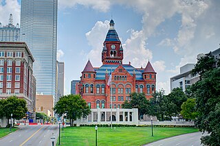
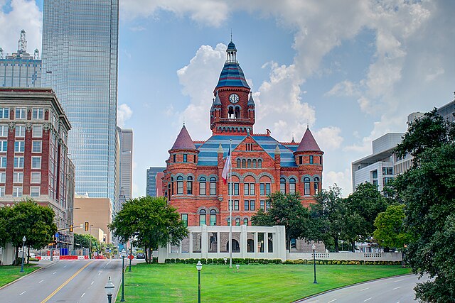
English: Old Red Museum |
| Date | |
| Source | Own work |
| Author | Dsdugan |
| Camera location | | View this and other nearby images on: OpenStreetMap |
|---|
Licensing
edit
I, the copyright holder of this work, hereby publish it under the following license:
| This file is made available under the Creative Commons CC0 1.0 Universal Public Domain Dedication. | |
| The person who associated a work with this deed has dedicated the work to the public domain by waiving all of their rights to the work worldwide under copyright law, including all related and neighboring rights, to the extent allowed by law. You can copy, modify, distribute and perform the work, even for commercial purposes, all without asking permission.
|
File history
Click on a date/time to view the file as it appeared at that time.
| Date/Time | Thumbnail | Dimensions | User | Comment | |
|---|---|---|---|---|---|
| current | 23:27, 20 September 2021 | | 2,048 × 1,366 (1.89 MB) | Dsdugan (talk | contribs) | Uploaded own work with UploadWizard |
You cannot overwrite this file.
File usage on Commons
There are no pages that use this file.
File usage on other wikis
The following other wikis use this file:
- Usage on es.wikipedia.org
- Usage on fa.wikipedia.org
- دالاس
- فورت ورث
- فرودگاه بینالمللی دالاس-فورت ورث
- مرکز پزشکی دانشگاه تگزاس ساوتوسترن
- دالاس ماوریکس
- ایتیاندتی
- ساوتوست ایرلاینز
- اکسانموبیل
- ایروینگ (تگزاس)
- موزه هنرهای معاصر فورت ورث
- پارک آبی فورت ورث
- مرکز سمفونی مورتون میرسون
- موزه هنر کیمبل
- دانشگاه زنان تگزاس
- آرلینگتون (تگزاس)
- پلینو
- دانشگاه متدیست جنوبی
- دانشگاه تگزاس در آرلینگتون
- دانشگاه تگزاس در دالاس
- ۷-ایلون
- نیمان مارکوس
- تگزاس اینسترومنتس
- دالاس کاوبویز
- میدان شکرگزاری
- کتابخانه ریاست جمهوری جورج دبلیو بوش
- گروه بک
- دانشگاه شمال تگزاس
- دانشگاه تگزاس کریستین
- کتابخانه عمومی دالاس
- بنک آو امریکا پلازا (دالاس)
- برج جیپی مورگان چیس (دالاس)
- باشگاه فوتبال دالاس افسی
- ورزشگاه ایتیاندتی
- ادیسون، تگزاس
- آلن (تگزاس)
- فرودگاه دالاس لاو
- گارلند (تگزاس)
- دالاس-فورت ورث
- دنتون (تگزاس)
- برج ریونیون
- فانتین پلیس
- ورزشگاه کاتن بول
- موزه آمون کارتر
- یادبود جان فیتزجرالد کندی
- پیتزا هات
- فریسکو (تگزاس)
- لوئیسویل (تگزاس)
- گرند پریری (تگزاس)
- ریچاردسون (تگزاس)
View more global usage of this file.