File:Rozw-teryt-WROC.png

Size of this preview: 800 × 600 pixels. Other resolutions: 320 × 240 pixels | 640 × 480 pixels | 1,024 × 768 pixels | 1,280 × 960 pixels | 1,600 × 1,200 pixels.
Original file (1,600 × 1,200 pixels, file size: 547 KB, MIME type: image/png)
Captions
Captions
Add a one-line explanation of what this file represents
Any autoconfirmed user can overwrite this file from the same source. Please ensure that overwrites comply with the guideline.
Summary
edit
| Description |
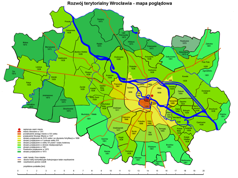
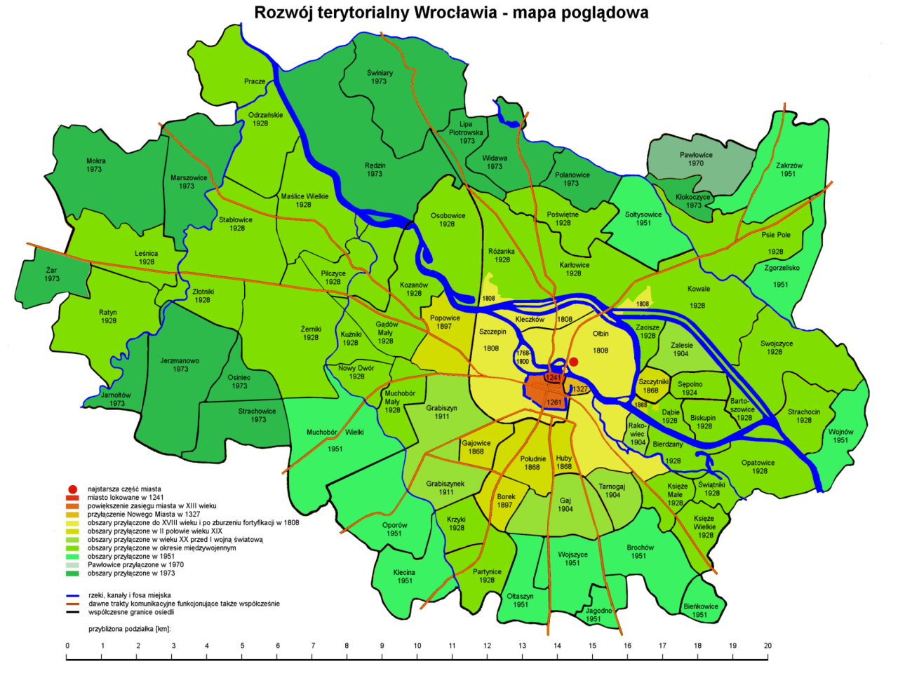
Polski: Rozwój terytorialny Wrocławia, mapa poglądowa rysunek wg planu miasta Wrocławia (PPWK 1979, ISBN 83-7000-019-3) z uwzględnieniem danych zawartych w Encyklopedii Wrocławia (Wyd. Dolnośląskie 2000, ISBN 83-7023-749-5) oraz na mapie M. Grügera (1911) |
| Date | |
| Source | Own work |
| Author | Julo |
| Other versions |
 |
Licensing
edit
I, the copyright holder of this work, hereby publish it under the following licenses:

|
Permission is granted to copy, distribute and/or modify this document under the terms of the GNU Free Documentation License, Version 1.2 or any later version published by the Free Software Foundation; with no Invariant Sections, no Front-Cover Texts, and no Back-Cover Texts. A copy of the license is included in the section entitled GNU Free Documentation License. |
This file is licensed under the Creative Commons Attribution-Share Alike 4.0 International, 3.0 Unported, 2.5 Generic, 2.0 Generic and 1.0 Generic license.
- You are free:
- to share – to copy, distribute and transmit the work
- to remix – to adapt the work
- Under the following conditions:
- attribution – You must give appropriate credit, provide a link to the license, and indicate if changes were made. You may do so in any reasonable manner, but not in any way that suggests the licensor endorses you or your use.
- share alike – If you remix, transform, or build upon the material, you must distribute your contributions under the same or compatible license as the original.
You may select the license of your choice.
File history
Click on a date/time to view the file as it appeared at that time.
| Date/Time | Thumbnail | Dimensions | User | Comment | |
|---|---|---|---|---|---|
| current | 21:06, 3 December 2023 | | 1,600 × 1,200 (547 KB) | WordSilent (talk | contribs) | replace ratyń with ratyn, as per official name of the district |
| 22:34, 17 August 2008 |  | 1,600 × 1,200 (599 KB) | Julo (talk | contribs) | size reduced ×<sup>5</sup>/<sub>8</sub> | |
| 22:14, 17 August 2008 |  | 2,560 × 1,920 (636 KB) | Julo (talk | contribs) | small correction |
You cannot overwrite this file.
File usage on Commons
The following page uses this file:
File usage on other wikis
The following other wikis use this file:
- Usage on de.wikipedia.org
- Usage on pl.wikipedia.org
- Usage on uk.wikipedia.org
- Usage on vep.wikipedia.org