File:Congo Brazzaville Topography.png
Size of this preview: 533 × 600 pixels. Other resolutions: 213 × 240 pixels | 427 × 480 pixels | 682 × 768 pixels | 910 × 1,024 pixels | 1,334 × 1,501 pixels.
Original file (1,334 × 1,501 pixels, file size: 3.52 MB, MIME type: image/png)
Captions
Captions
Add a one-line explanation of what this file represents
Summary
edit
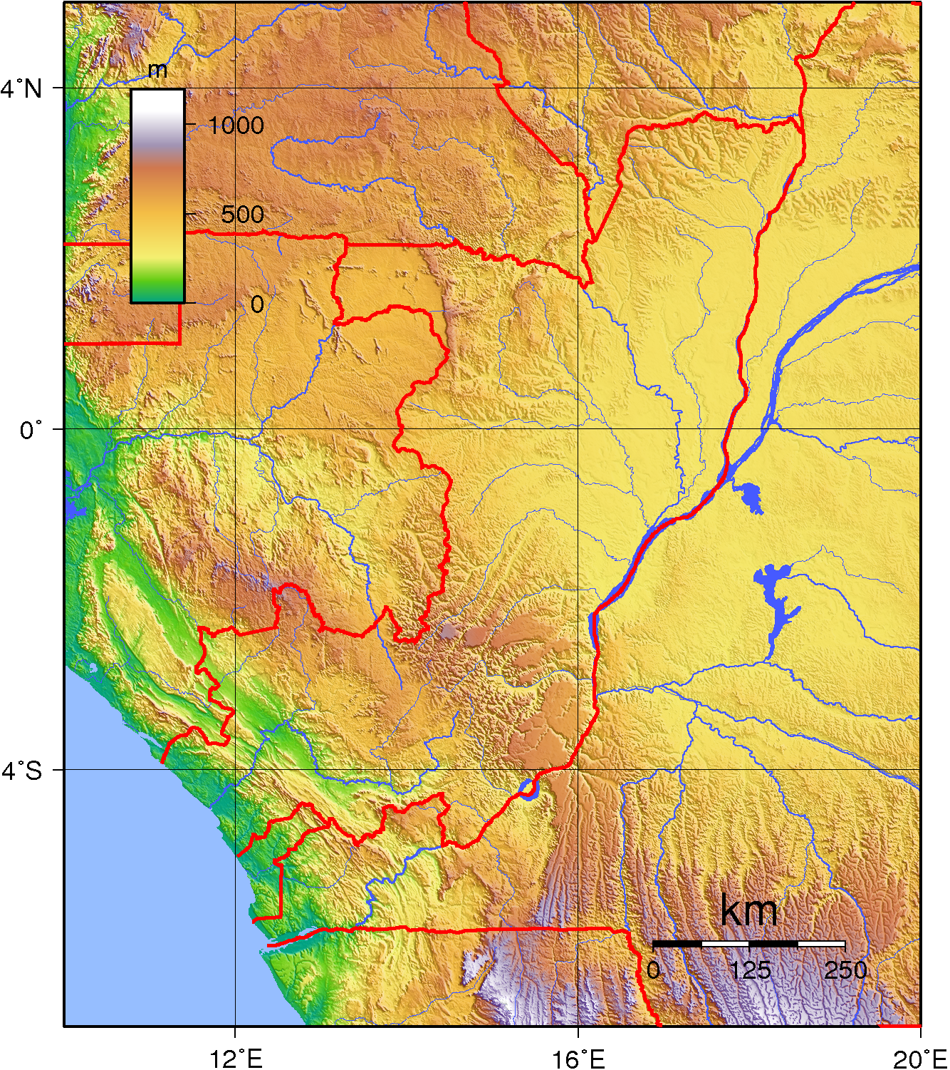
| Description | Topographic map of the Republic of the Congo (Brazzaville). Created with GMT from public domain SRTM data. |
| Date | |
| Source | Own work |
| Author | Sadalmelik |
Licensing
edit
| This work has been released into the public domain by its author, Sadalmelik. This applies worldwide. In some countries this may not be legally possible; if so: Sadalmelik grants anyone the right to use this work for any purpose, without any conditions, unless such conditions are required by law. |
File history
Click on a date/time to view the file as it appeared at that time.
| Date/Time | Thumbnail | Dimensions | User | Comment | |
|---|---|---|---|---|---|
| current | 19:28, 29 June 2007 | | 1,334 × 1,501 (3.52 MB) | Sadalmelik (talk | contribs) | {{Information |Description=Topographic map of the Republic of the Congo (Brazzaville). Created wth GMT from public domain SRTM data. |Source=self-made |Date=June 29, 2007 |Author= Sadalmelik }} [[Category:Maps of the Republic of the C |
You cannot overwrite this file.
File usage on Commons
The following page uses this file:
File usage on other wikis
The following other wikis use this file:
- Usage on af.wikipedia.org
- Usage on da.wikipedia.org
- Usage on en.wikipedia.org
- Usage on es.wikipedia.org
- Usage on fa.wikipedia.org
- Usage on hu.wikipedia.org
- Usage on ja.wikipedia.org
- Usage on ka.wikipedia.org
- Usage on lt.wikipedia.org
- Usage on mdf.wikipedia.org
- Usage on no.wikipedia.org
- Usage on uk.wikipedia.org
- Usage on vep.wikipedia.org
- Usage on zh.wikipedia.org