File:Carteroute50.jpg
No higher resolution available.
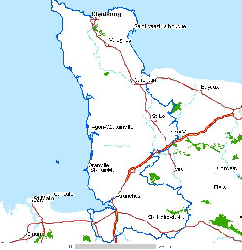
Carteroute50.jpg (500 × 515 pixels, file size: 77 KB, MIME type: image/jpeg)
Captions
Captions
Map of Cotentin peninsula

|
This map image could be re-created using vector graphics as an SVG file. This has several advantages; see Commons:Media for cleanup for more information. If an SVG form of this image is available, please upload it and afterwards replace this template with
{{vector version available|new image name}}.
It is recommended to name the SVG file “Carteroute50.svg”—then the template Vector version available (or Vva) does not need the new image name parameter. |

Summary
edit
| Description |
English: Map of Cotentin peninsula
Français : Carte routière du départment Manche
Nederlands: kaart van Cotentin
Légende :  |
| Date | |
| Source | Cette carte est généreusement fournie par l'IAAT (Institut atlantique d'aménagement du territoire). From French Wiki. Uploaded there by fr:Utilisateur:Archeos under GFDL |
| Author | IAAT |
Licensing
edit

|
Permission is granted to copy, distribute and/or modify this document under the terms of the GNU Free Documentation License, Version 1.2 or any later version published by the Free Software Foundation; with no Invariant Sections, no Front-Cover Texts, and no Back-Cover Texts. A copy of the license is included in the section entitled GNU Free Documentation License. |
| This file is licensed under the Creative Commons Attribution-Share Alike 3.0 Unported license. | ||
| ||
| This licensing tag was added to this file as part of the GFDL licensing update. |
File history
Click on a date/time to view the file as it appeared at that time.
| Date/Time | Thumbnail | Dimensions | User | Comment | |
|---|---|---|---|---|---|
| current | 23:55, 3 January 2006 | | 500 × 515 (77 KB) | Bansp (talk | contribs) | {{Information |Description = Carte du département Manche |Source = frwiki, uploaded there by [:fr:Utilisateur:Archeos]] under GFDL |Date = 6 may 2004 |Author = Cette carte est généreusement fournie par l'IAAT ([http://www.iaat.org Institut atlantique d |
You cannot overwrite this file.
File usage on Commons
There are no pages that use this file.
File usage on other wikis
The following other wikis use this file:
- Usage on ca.wikipedia.org
- Usage on cs.wikipedia.org
- Usage on el.wikipedia.org
- Usage on en.wikipedia.org
- Usage on es.wikipedia.org
- Usage on ext.wikipedia.org
- Usage on fa.wikipedia.org
- Usage on fi.wikipedia.org
- Usage on fr.wikipedia.org
- Usage on he.wikipedia.org
- Usage on hy.wikipedia.org
- Usage on id.wikipedia.org
- Usage on it.wikipedia.org
- Usage on ja.wikipedia.org
- Usage on ko.wikipedia.org
- Usage on la.wikipedia.org
- Usage on lt.wikipedia.org
- Usage on mk.wikipedia.org
- Usage on mr.wikipedia.org
- Usage on nn.wikipedia.org
- Usage on pcd.wikipedia.org
- Usage on pl.wikipedia.org
- Usage on pt.wikipedia.org
- Usage on simple.wikipedia.org
- Usage on sk.wikipedia.org
- Usage on sv.wikipedia.org
- Usage on tr.wikipedia.org
- Usage on uk.wikipedia.org
- Usage on vi.wikipedia.org
- Usage on zh.wikipedia.org