File:NowaMapaA18.svg

Size of this PNG preview of this SVG file: 643 × 599 pixels. Other resolutions: 258 × 240 pixels | 515 × 480 pixels | 824 × 768 pixels | 1,099 × 1,024 pixels | 2,198 × 2,048 pixels | 776 × 723 pixels.
Original file (SVG file, nominally 776 × 723 pixels, file size: 167 KB)
Captions
Captions
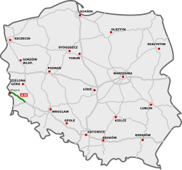
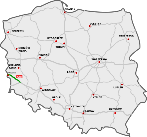
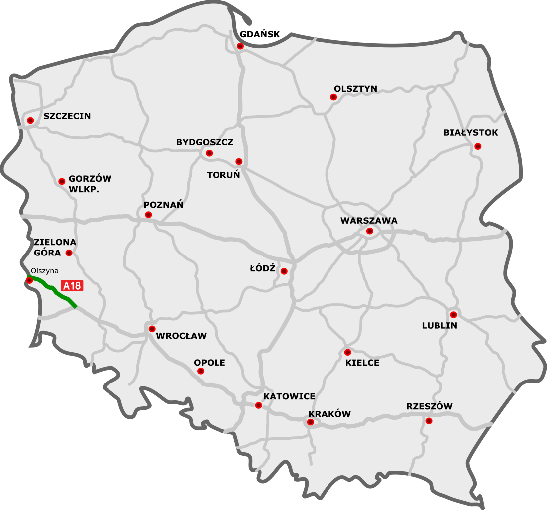
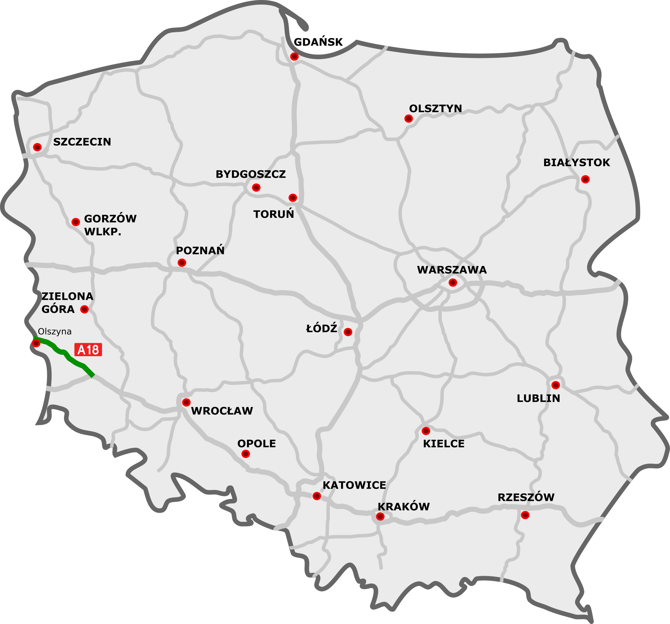
A18 Highway on the map of Poland
Any autoconfirmed user can overwrite this file from the same source. Please ensure that overwrites comply with the guideline.
Summary
edit
| Description |
Polski: Przebieg autostrady A18:
odcinki istniejące odcinki w budowie odcinki projektowane English: A18 motorway in Poland:
existing sections sections under construction planned sections Deutsch: Autobahn A18 in Polen: Strecken unter Verkehr Strecken in Bau geplante Strecken |
||
| Date | |||
| Source |
|
||
| Author |
|
||
| SVG development | This file uses embedded text that can be easily translated using a text editor.
|
Licensing
edit
I, the copyright holder of this work, hereby publish it under the following license:
This file is licensed under the Creative Commons Attribution 3.0 Unported license.
- You are free:
- to share – to copy, distribute and transmit the work
- to remix – to adapt the work
- Under the following conditions:
- attribution – You must give appropriate credit, provide a link to the license, and indicate if changes were made. You may do so in any reasonable manner, but not in any way that suggests the licensor endorses you or your use.
Original upload log
edit
This image is a derivative work of the following images:
- DocelowyUkladDrog.svg licensed with Cc-by-3.0, Cc-by-3.0
- 2009-08-30T16:41:32Z Sliwers 784x723 (155471 Bytes) Darker color.
- 2009-08-30T16:40:18Z Sliwers 784x723 (155471 Bytes) Cropped.
- 2009-08-30T16:36:58Z Sliwers 1073x790 (154212 Bytes) {{Information |Description={{en|1=Map of the planned free- and expressway network in Poland.}} {{pl|1=Docelowy układ autostrad i dróg ekspresowych w Polsce.}} {{de|1=Das Autobahn- und Schnellstraßennetz Polens, geplanter E
Uploaded with derivativeFX
File history
Click on a date/time to view the file as it appeared at that time.
| Date/Time | Thumbnail | Dimensions | User | Comment | |
|---|---|---|---|---|---|
| current | 17:26, 16 March 2024 | | 776 × 723 (167 KB) | Kirt93 (talk | contribs) | Update - reconstruction of the 2nd carriageway finished |
| 14:21, 17 September 2021 |  | 776 × 723 (168 KB) | Daniel749 (talk | contribs) | update | |
| 07:33, 14 August 2020 |  | 776 × 723 (168 KB) | Daniel749 (talk | contribs) | update | |
| 20:19, 26 December 2019 |  | 776 × 723 (171 KB) | Poznaniak (talk | contribs) | aktualizacja | |
| 19:48, 23 December 2015 |  | 776 × 723 (164 KB) | Daniel749 (talk | contribs) | ||
| 13:27, 22 December 2013 |  | 785 × 724 (89 KB) | Daniel749 (talk | contribs) | nowe tabliczki | |
| 18:33, 19 December 2010 |  | 785 × 724 (88 KB) | Sliwers (talk | contribs) | Thickness corrections | |
| 18:05, 19 December 2010 |  | 785 × 724 (86 KB) | Sliwers (talk | contribs) | Corrected background | |
| 18:05, 9 October 2010 |  | 784 × 723 (63 KB) | Sliwers (talk | contribs) | Added expressways | |
| 20:38, 4 September 2009 |  | 784 × 723 (40 KB) | Sliwers (talk | contribs) | Thicker lines |
You cannot overwrite this file.
File usage on Commons
The following 13 pages use this file:
- User:Chumwa/OgreBot/Potential transport maps/2019 December 21-31
- User:Chumwa/OgreBot/Transport Maps/2015 December 21-31
- User:Chumwa/OgreBot/Transport Maps/2019 December 21-31
- User:Chumwa/OgreBot/Transport Maps/2020 August 11-20
- User:Chumwa/OgreBot/Transport Maps/2021 September 11-20
- User:Chumwa/OgreBot/Transport Maps/2024 March 11-20
- User:Chumwa/OgreBot/Travel and communication maps/2019 December 21-31
- User:Chumwa/OgreBot/Travel and communication maps/2020 August 11-20
- User:Chumwa/OgreBot/Travel and communication maps/2021 September 11-20
- User:Chumwa/OgreBot/Travel and communication maps/2024 March 11-20
- User:Sliwers
- Commons:Files used on the AARoads Wiki/89
- Category:Freeway A18 (Poland)
File usage on other wikis
The following other wikis use this file:
- Usage on cs.wikipedia.org
- Usage on de.wikipedia.org
- Usage on de.wikivoyage.org
- Usage on en.wikipedia.org
- Usage on fr.wikipedia.org
- Usage on hu.wikipedia.org
- Usage on it.wikipedia.org
- Usage on ja.wikipedia.org
- Usage on lmo.wikipedia.org
- Usage on lt.wikipedia.org
- Usage on nl.wikipedia.org
- Usage on pl.wikipedia.org
- Usage on ro.wikipedia.org
- Usage on sk.wikipedia.org
- Usage on sv.wikipedia.org
- Usage on uk.wikipedia.org
- Usage on vi.wikipedia.org
- Usage on www.wikidata.org