File:Ananyivskyi-Raion.png
Size of this preview: 464 × 599 pixels. Other resolutions: 186 × 240 pixels | 372 × 480 pixels | 595 × 768 pixels | 793 × 1,024 pixels | 2,000 × 2,582 pixels.
Original file (2,000 × 2,582 pixels, file size: 349 KB, MIME type: image/png)
Captions
Captions
Add a one-line explanation of what this file represents
Summary
edit
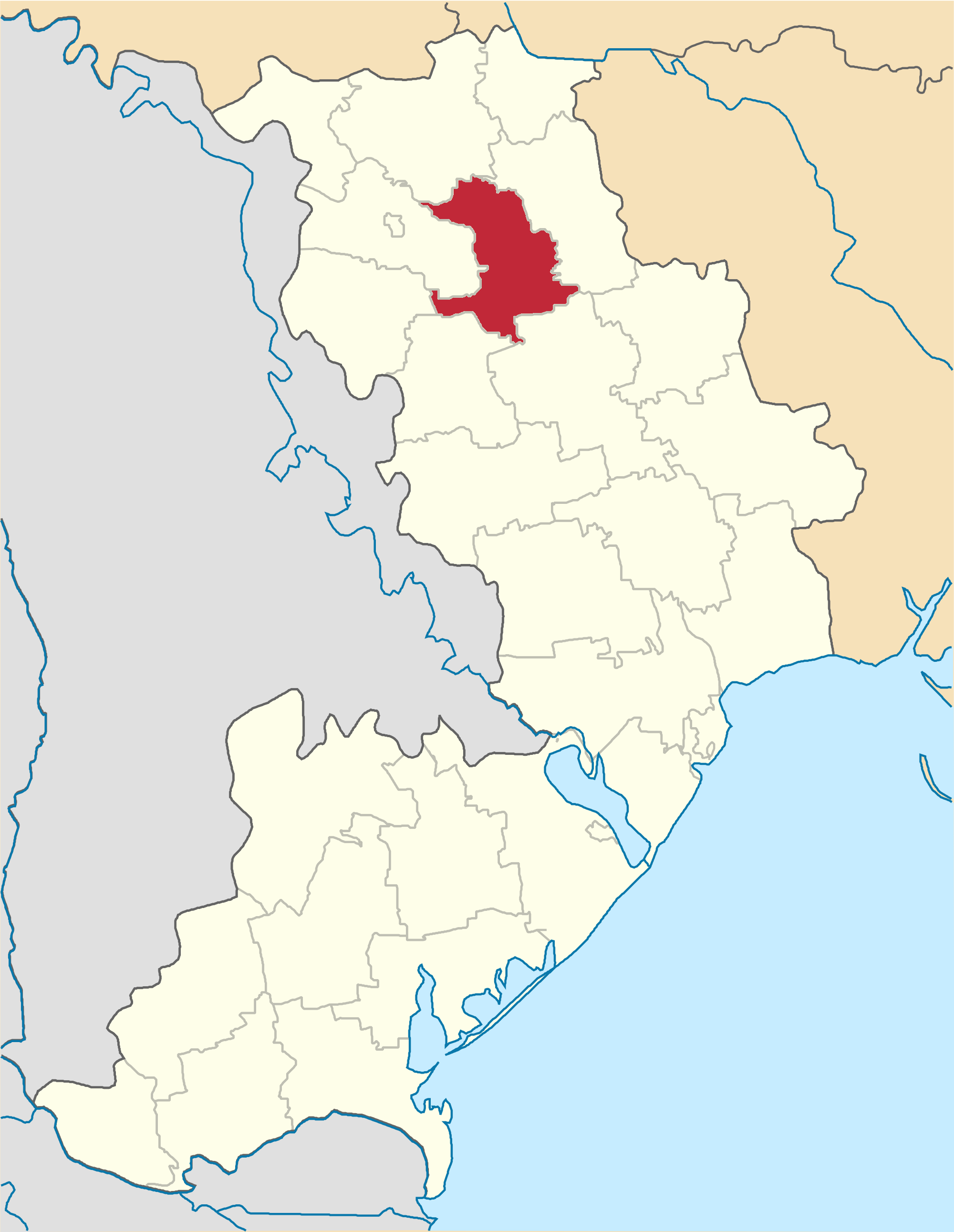
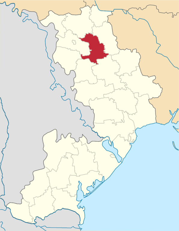
| Description | Ananyivskyi-Raion map |
| Date | |
| Source | Olegzima |
| Author |
Licensing
edit
| I, the copyright holder of this work, release this work into the public domain. This applies worldwide. In some countries this may not be legally possible; if so: I grant anyone the right to use this work for any purpose, without any conditions, unless such conditions are required by law. |
File history
Click on a date/time to view the file as it appeared at that time.
| Date/Time | Thumbnail | Dimensions | User | Comment | |
|---|---|---|---|---|---|
| current | 17:16, 11 June 2015 | | 2,000 × 2,582 (349 KB) | Andrew J.Kurbiko (talk | contribs) | upd |
| 20:16, 14 January 2007 |  | 296 × 410 (54 KB) | Olegzima (talk | contribs) | {{Image |Name= Ananyivskyi-Raion |Description= map |Author= Olegzima |Source= Olegzima |Date= Jan 2007 |Licensing= {{PD}} }} Category:Raions_of_Odesa_Oblast |
You cannot overwrite this file.
File usage on Commons
The following page uses this file:
File usage on other wikis
The following other wikis use this file:
- Usage on be-tarask.wikipedia.org
- Usage on be.wikipedia.org
- Usage on bg.wikipedia.org
- Usage on ce.wikipedia.org
- Usage on crh.wikipedia.org
- Usage on cs.wikipedia.org
- Usage on de.wikipedia.org
- Usage on en.wikipedia.org
- Usage on es.wikipedia.org
- Usage on fa.wikipedia.org
- Usage on hy.wikipedia.org
- Usage on it.wikipedia.org
- Usage on ka.wikipedia.org
- Usage on pl.wikipedia.org
- Usage on ro.wikipedia.org
- Usage on ru.wikipedia.org
- Usage on sco.wikipedia.org
- Usage on uk.wikipedia.org
- Ананьївський район
- Вікіпедія:Шаблони/Навігаційні/Географія/Україна/Одеська область
- Вікіпедія:Проєкт:Населені пункти України/Сільради Кі-О
- Адміністративний устрій Одеської області
- Шаблон:Адміністративний устрій Ананьївського району
- Ананьївська Перша сільська рада
- Ананьївська Друга сільська рада
- Байтальська сільська рада
- Гандрабурівська сільська рада
- Жеребківська сільська рада (Ананьївський район)
- Коханівська сільська рада (Ананьївський район)
- Кохівська сільська рада
- Новогеоргіївська сільська рада
- Новоолександрівська сільська рада (Ананьївський район)
- Новоселівська сільська рада (Ананьївський район)
- Романівська сільська рада (Ананьївський район)
- Точилівська сільська рада
- Шимківська сільська рада
- Історія змін адміністративно-територіального устрою Одеської області
- Usage on uk.wikisource.org
- Usage on vi.wikipedia.org
- Usage on www.wikidata.org
- Usage on zh-min-nan.wikipedia.org
- Usage on zh.wikipedia.org