File:Un-ethiopia.png

Original file (3,038 × 2,257 pixels, file size: 1.6 MB, MIME type: image/png)
Captions
Captions
Summary
edit| Description |
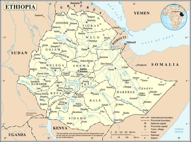
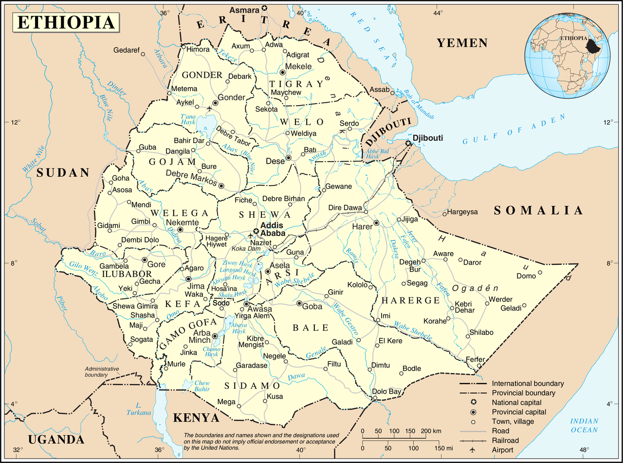
English: This map is not up to date. The internal borders show the provinces which were replaced by regions/states in 1995.
Nederlands: Deze kaart is verouderd. De interne grenzen tonen de provincies die in 1995 werden vervangen door regio's/staten. |
|||
| Date | ||||
| Source | The United Nations Cartographic Section (UNCS) | |||
| Author | Cartographer of the United Nations | |||
| Permission (Reusing this file) |
|

File history
Click on a date/time to view the file as it appeared at that time.
| Date/Time | Thumbnail | Dimensions | User | Comment | |
|---|---|---|---|---|---|
| current | 01:00, 24 October 2007 | | 3,038 × 2,257 (1.6 MB) | Jeroen (talk | contribs) | {{UN map}} Category:Maps of Ethiopia |
You cannot overwrite this file.
File usage on Commons
There are no pages that use this file.
File usage on other wikis
The following other wikis use this file:
- Usage on ca.wikipedia.org
- Usage on ckb.wikipedia.org
- Usage on en.wikipedia.org
- Usage on eo.wikipedia.org
- Usage on fa.wikipedia.org
- Usage on fr.wikipedia.org
- Usage on id.wikipedia.org
- Usage on mzn.wikipedia.org
- Usage on nl.wikipedia.org
- Usage on pl.wiktionary.org
- Usage on uk.wikipedia.org
- Usage on ur.wikipedia.org
- Usage on vi.wikipedia.org
- Usage on www.wikidata.org