File:Netherlands pol87.jpg

Size of this preview: 527 × 599 pixels. Other resolutions: 211 × 240 pixels | 422 × 480 pixels | 675 × 768 pixels | 1,036 × 1,178 pixels.
Original file (1,036 × 1,178 pixels, file size: 266 KB, MIME type: image/jpeg)
Captions
Captions
Add a one-line explanation of what this file represents

Summary
edit
| Description |
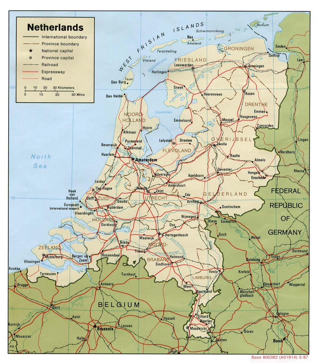
English: Map of the Netherlands. |
| Date | |
| Source | Netherlands (Political) 1987 from Perry-Castañeda Library Map Collection: Netherlands Maps |
| Author | U.S. Central Intelligence Agency |
| Permission (Reusing this file) |
Public domain |
Licensing
edit
| This image is a work of a Central Intelligence Agency employee, taken or made as part of that person's official duties. As a Work of the United States Government, this image or media is in the public domain in the United States.
|

|
File history
Click on a date/time to view the file as it appeared at that time.
| Date/Time | Thumbnail | Dimensions | User | Comment | |
|---|---|---|---|---|---|
| current | 08:23, 14 January 2005 | | 1,036 × 1,178 (266 KB) | Patrick (talk | contribs) | upload again, bottom was missing |
| 00:10, 14 January 2005 |  | 1,036 × 1,178 (266 KB) | Patrick (talk | contribs) | map of the Netherlands |
You cannot overwrite this file.
File usage on Commons
The following 2 pages use this file:
File usage on other wikis
The following other wikis use this file:
- Usage on ar.wikipedia.org
- Usage on ast.wikipedia.org
- Usage on bg.wikipedia.org
- Usage on br.wikipedia.org
- Usage on da.wikipedia.org
- Usage on de.wikipedia.org
- Usage on el.wikipedia.org
- Usage on en.wikipedia.org
- Usage on es.wikipedia.org
- Usage on eu.wikipedia.org
- Usage on fr.wikipedia.org
- Usage on hr.wiktionary.org
- Usage on hu.wikipedia.org
- Usage on id.wikipedia.org
- Usage on it.wikipedia.org
- Usage on lez.wikipedia.org
- Usage on mk.wikipedia.org
- Usage on mn.wikipedia.org
- Usage on nn.wikipedia.org
- Usage on pl.wikinews.org
- Usage on pl.wiktionary.org
- Usage on rm.wikipedia.org
- Usage on ru.wikipedia.org
- Usage on scn.wikipedia.org
- Usage on sv.wikipedia.org
- Usage on uk.wikipedia.org
- Usage on www.wikidata.org
- Usage on zh.wikipedia.org