松林泥炭地 (新澤西州)
松林泥炭地(英語:、)是一片橫跨新澤西州南邊茂密森林的沿岸平原地區。由於這裡的沙質、酸性、不肥沃的土壤,以及早期歐洲殖民者進口的農作物不易種植,因此取了「pine barrens」這樣的地名。

位於蘋果派山守望塔上遼望的北面視野,同時也是這一帶的最高點
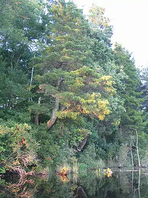
松林泥炭地的阿特申湖
照片
 阿特申湖
阿特申湖 阿特申湖
阿特申湖 阿特申湖
阿特申湖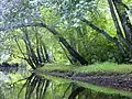 巴茨托河
巴茨托河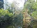 马利卡河
马利卡河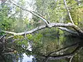 马利卡河
马利卡河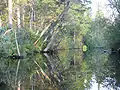 马利卡河
马利卡河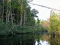 马利卡河
马利卡河
外部連結
| 维基共享资源上的相关多媒体资源:松林泥炭地 |
行政
歷史與生態學
非營利組織與其他當地名勝
- NJ Pinelands and Down Jersey
- Photos of Colliers Mills WMA (页面存档备份,存于)
- Forked River Mountain Coalition (页面存档备份,存于)
- Pine Barrens Ecology & Protection - Pinelands Preservation Alliance (页面存档备份,存于)
- Pine Barrens Landscape and Habitat Photos (页面存档备份,存于)
- Piney Power.com (页面存档备份,存于)
- Batona Trail
- South Jersey Tourism Corporation (页面存档备份,存于)
- Citizens United to Protect the Maurice River and Its Tributaries, Inc. (页面存档备份,存于)
- Pinelands photo galleries of native flora,fauna, and landscapes (页面存档备份,存于)
This article is issued from Wikipedia. The text is licensed under Creative Commons - Attribution - Sharealike. Additional terms may apply for the media files.