| Sheer Aah yn Ollee Oxfordshire |
|||
|---|---|---|---|
| — Coontae jesh-chliaghtagh — | |||
|
|||
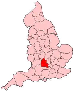 Soiaghey Heer Aah yn Ollee er caslys-çheerey Hostyn |
|||
 Slystyn Heer Aah yn Ollee: 1) Aah yn Ollee 2) Cherwell 3) Sheer Aah yn Ollee Yiass 4) Vale of White Horse 5) Sheer Aah yn Ollee Heear |
|||
| Co-ordnaidyn: 51°45′00″N 01°16′48″W / 51.75°N 1.28°W | |||
| Çheer | |||
| Çheer cho-ayrnagh | |||
| Ard | Sostyn Hiar Yiass | ||
| Ard-oik reiragh | Aah yn Ollee | ||
| Reiltys | |||
| - Colught | Coonseil Coontae Heer Aah yn Ollee | ||
| - MPyn | 6 |
||
| Eaghtyr | |||
| - Yn clane | 2,605 km² (1,005.8 mi ker) | ||
| Earroo yn phobble (2008)[1] | |||
| - Yn clane | 639,700 | ||
| - Glooaght y phobble | 246/km² (637.1/mi ker) | ||
| Cryss hraa | GMT (UTC+0) | ||
| - Sourey (TTSL) | BST (UTC+1) | ||
| ISO 3166-2 | GB-OXF | ||
| Coad ONS | 38 | ||
| NUTS 3 | UKJ14 | ||
| Ynnyd-eggey | www.oxfordshire.gov.uk | ||

She coontae reiragh as jesh-chliaghtagh ayns Sostyn Heear Yiass eh Sheer Aah yn Ollee (Baarle: Oxfordshire). T'eh çhemmit liorish Warwickshire da'n' çheear hwoaie, Northamptonshire da'n çhiar hwoaie, Buckinghamshire da'n çhiar, Berkshire da'n jiass, Wiltshire da'n çheear yiass, as Gloucestershire da'n çheear.
Ta queig slystyn echey: Oxford, Cherwell, Sheer Aah yn Ollee Yiass, Vale of White Horse, as Sheer Aah yn Ollee Heear.
Imraaghyn
- ↑ Population estimates for UK, England and Wales, Scotland and Northern Ireland, Mid-2008. National Statistics Online. Office for National Statistics.
|
|
She bun ta'n art shoh. Cur rish, son foays y yannoo da Wikipedia. |
This article is issued from Wikipedia. The text is licensed under Creative Commons - Attribution - Sharealike. Additional terms may apply for the media files.