| Inver Mooar Arklow An tInbhear Mór | ||
 | ||
|---|---|---|
| Jarroo-raa: Maoin na mara ár muinighin | ||
 | ||
| Soiaghey | ||
| ||
| Ingagh ogheragh Nerin T240735 | ||
| Staydraa | ||
| Queiggey: | Queiggey Lion | |
| Coontae: | Coontae Cheeill Mantan | |
| Dáil Éireann: | Keeill Mantan | |
| Parlamaid ny h-Oarpey: | Shiar | |
| Coad jeeley: | +353 404 | |
| Eaghtyr: | 6.64 km²[1] | |
| Yrjid: | 2 m | |
| Earroo yn phobble (2006) - Balley: - Binn: |
11,712[2] 47[2] | |
| Ynnyd-eggey: www.arklow.ie | ||
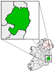
Ta Inver Mooar (Yernish: An tInbhear Mór, Baarle: Arklow) ny valley shendeeagh ayns Coontae Cheeill Mantan er coose hiar Nerin. Va'n balley bunnit 'sy nuyoo eash liorish ny Loghlynee, as v'eh ny voayl er nane jeh ny caggaghyn smoo fuilltagh ayns Irree magh ny bleeaney 1798. Nish, t'eh ny valley troailtagh lesh 11,759 cummaltee rere coontey-pobble ny bleeaney 2006, as t'eh ny treeoo balley smoo 'sy choontae. Ta'n balley soit ec inver ny h-awin Abhóca.
Jeeagh er neesht
Imraaghyn
- ↑ "Table 6 - Population and area of each Province, County, City, urban area, rural area and Electoral Division, 2002 and 2006" (PDF). Census 2006, Volume 1 - Population Classified by Area. Oik Staydraa Nerin. 2007-04-26. dgn. d. 78. Feddynit magh er 2010-07-25. (Baarle)
- 1 2 "Table 7 - Persons in each town of 1,500 population and over, distinguishing those within legally defined boundaries and in suburbs or environs, 2002 and 2006" (PDF). Census 2006, Volume 1 - Population Classified by Area. Oik Staydraa Nerin. 2007-04-26. dgn. d. 119. Feddynit magh er 2010-07-25. (Baarle)
This article is issued from Wikipedia. The text is licensed under Creative Commons - Attribution - Sharealike. Additional terms may apply for the media files.
