| Baile an Bhiataigh Bettystown (en) |
|
|---|---|
 Thie-oast yn Neptune ayns Baile an Bhiataigh |
|
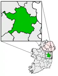
[[File:Ireland location map.svg|250px|{{#if:||{{#if:Baile an Bhiataigh|Baile an Bhiataigh|Baile an Bhiataigh er caslys-çheerey]] Baile an Bhiataigh |
|
| Co-ordnaidyn: 53°41′55″N 06°14′40″W / 53.69861°N 6.24444°W | |
| Çheer | |
| Queiggey | |
| Coontae | Yn Vee |
| Dáil Éireann | Lhoo |
| Parlamaid yn Oarpey | Shiar |
| Yrjid | 4 m (13 tr) |
| Earroo yn phobble (2006)[1] | |
| - Baljagh | 8,978 |
| Myr cooid jeh'n valley coontey-pobble An Inse-Baile an Bhiataigh-Baile Uí Mhornáin | |
| Cryss hraa | WET (UTC+0) |
| - Sourey (TTSL) | IST (UTC+1) |
| Coad(yn) çhellvane | +353 41 |
Ta Baile an Bhiataigh (Baarle: Bettystown) ny valley beg ayns Coontae yn Vee, Nerin, ta gaase dy tappee. Myrane lesh ny baljyn beggey faggyssagh jeh'n Inse as Baile Uí Mhornáin, ta Baile an Bhiataigh ny chooid jeh'n valley coontey-pobble An Inse-Baile an Bhiataigh-Baile an Mhornáin.
Imraaghyn
- ↑ "Table 12 - Alphabetical list of Towns with their population, 2002 and 2006" (PDF). Census 2006, Volume 1 - Population Classified by Area. Príomh Oifig Staidrimh na hÉireann. 2007-04-26. dgn. d. 142. Feddynit magh er 2011-07-17. (Baarle)
Jeeagh er neesht
Kianglaghyn mooie
- (Baarle) Coontys giare er Baile an Bhiataigh 'sy vlein 1837, veih'n lioar A Topographical Dictionary of Ireland (1837) liorish Samuel Lewis
This article is issued from Wikipedia. The text is licensed under Creative Commons - Attribution - Sharealike. Additional terms may apply for the media files.