| Baile Átha Buí Athboy (en) |
|
|---|---|
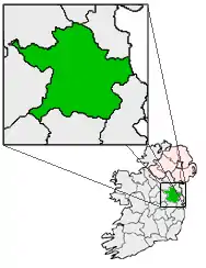
[[File:Ireland location map.svg|250px|{{#if:||{{#if:Baile Átha Buí|Baile Átha Buí|Baile Átha Buí er caslys-çheerey]] Baile Átha Buí |
|
| Co-ordnaidyn: 53°37′00″N 06°55′00″W / 53.616667°N 6.916667°W | |
| Çheer | |
| Queiggey | |
| Coontae | Yn Vee |
| Dáil Éireann | Yn Vee Heear |
| Parlamaid yn Oarpey | Shiar |
| Yrjid | 61 m (200 tr) |
| Earroo yn phobble (2011) | |
| - Yn clane | 2,522 |
| Cryss hraa | WET (UTC+0) |
| - Sourey (TTSL) | IST (UTC+1) |
| Coad(yn) çhellvane | +353 46 |
| Ingagh ogheragh Nerin | N711642 |
Ta Baile Átha Buí (Baarle: Athboy, Yernish son Balley Aah Buigh) ny valley beg eirinagh ayns Coontae yn Vee, Nerin. T'eh ny lhie er çheet ry-cheilley ny raaidyn N51 as R154. T'eh soit mygeayrt 19 km veih preeu-valley yn choontae, yn Ooive, faggys da'n joarey lesh Coontae yn Eearvee. Ta'n Ghaeltacht veg Ráth Cairn ny lhie er gerrey da'n valley.
This article is issued from Wikipedia. The text is licensed under Creative Commons - Attribution - Sharealike. Additional terms may apply for the media files.