Hertfordshire
Hertfordshire [ˈhɑːfədʃə] as en ferwaltingsgraafskap (üüb Ingels: administrative county) an seremoniel graafskap (ceremonial county) uun Ingelun. Det graafskap hee 1.195.672 lidj (2020)[1]. At hoodsteed as Hertford. Det hiart tu’t ferwaltingsregiuun Uasten faan Ingelun.

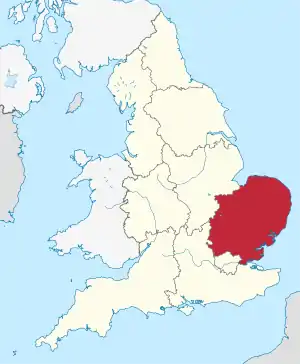
Hertfordshire uun Ingelun
Geografii
Steeden
Dön tjiin gratst steeden uun't graafskap san:
| # | Steed | Lidj (2020)[2] |
|---|---|---|
| 1 | Watford | 142.084 |
| 2 | Hemel Hempstead | 103.458 |
| 3 | Stevenage | 94.371 |
| 4 | St. Albans | 88.448 |
| 5 | Welwyn Garden | 51.248 |
| 6 | Cheshunt | 47.072 |
| 7 | Hatfield | 46.565 |
| 8 | Hoddesdon | 44.077 |
| 9 | Bishop's Stortford | 41.695 |
| 10 | Borehamwood | 38.353 |
Iindialing faan Ferwalting

Koord faan dön 10 Distrikten uun det Ferwaltingsgraafskap an Seremoniel Graafskap Hertfordshire:
1. North Hertfordshire
2. Stevenage
3. East Hertfordshire
4. Dacorum
5. City of St Albans
6. Welwyn Hatfield
7. Broxbourne
8. Three Rivers
9. Watford
10. Hertsmere
2. Stevenage
3. East Hertfordshire
4. Dacorum
5. City of St Albans
6. Welwyn Hatfield
7. Broxbourne
8. Three Rivers
9. Watford
10. Hertsmere
At ferwaltingsgraafskap an seremoniel graafskap Hertfordshire hee tjiin distrikten:
| # | Koord | Distrikt | Lidj (2020)[1] | Hoodsteed |
|---|---|---|---|---|
| 7 | Broxbourne | 97.592 | Cheshunt | |
| 4 | Dacorum | 155.457 | Hemel Hampstead | |
| 3 | East Hertfordshire | 151.786 | Hertford | |
| 10 | Hertsmere | 105.471 | Borehamwood | |
| 1 | North Hertfordshire | 133.463 | Letchworth | |
| 5 | City of St Albans | 149.317 | St Albans | |
| 2 | Stevenage | 88.104 | Stevenage | |
| 8 | Three Rivers | 93.966 | Rickmansworth | |
| 9 | Watford | 96.623 | Watford | |
| 6 | Welwyn Hatfield | 123.893 | Welwyn Garden City |
Kwelen
- United Kingdom: Administrative Division, citypopulation.de
- Hertfordshire: County in East of England, citypopulation.de
Graafskapen an Unitary Authorities faan a Uasten faan Ingelun
Graafskapen:
Cambridgeshire |
Essex |
Hertfordshire |
Norfolk |
Suffolk
Unitary Authorities:
Bedford |
Central Bedfordshire |
Luton |
Peterborough |
Southend-on-Sea |
Thurrock
This article is issued from Wikipedia. The text is licensed under Creative Commons - Attribution - Sharealike. Additional terms may apply for the media files.