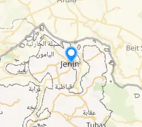
Jenin
Jenin[1] (arabieraz: جنين Ǧanīn; hebreeraz: ג'נין) Zisjordaniako hiria da. Bertan 35.000 biztanletik gora aurki daitezke. 1993ko Osloko Hitzarmenaz geroztik Palestinaren menpe dagoen hiria da.
| Jenin جنين | |
|---|---|
| hiria | |
 Errefuxiatuen kanpalekua | |
| Administrazioa | |
| Herrialdea | |
| Gobernazioa | Jenin |
| Alkatea | Hadem Rida |
| Izen ofiziala | جنين |
| Jatorrizko izena | جنين |
| Geografia | |
| Koordenatuak | 32°27′40″N 35°18′00″E |
 | |
| Azalera | 37,3 km² |
| Demografia | |
| Dentsitatea | 1.045,71 bizt/km² |
| Informazio gehigarria | |
| Ordu eremua | UTC+02:00 eta UTC+03:00 |
| Hiri senidetuak | Coslada eta Sidi Bennour (en) |
Klima
| | |||||||||||||
|---|---|---|---|---|---|---|---|---|---|---|---|---|---|
| Hila | Urt | Ots | Mar | Api | Mai | Eka | Uzt | Abu | Ira | Urr | Aza | Abe | Urtekoa |
| Batez besteko tenperatura maximoa (°C) | 17.4 | 18.2 | 21.6 | 28.3 | 31 | 32.9 | 33.6 | 34.2 | 33.2 | 30.6 | 25 | 18.8 | 27.1 |
| Batez besteko tenperatura minimoa (°C) | 6.8 | 7.1 | 8.6 | 11.2 | 14.0 | 17.3 | 19.6 | 21.1 | 19.8 | 16.1 | 11.8 | 8.7 | 13.5 |
| Pilatutako prezipitazioa (mm) | 107 | 62 | 65 | 25 | 6 | 0 | 0 | 0 | 0 | 16 | 40 | 93 | 414 |
| Iturria: Garraio eta Komunikazio Ministerioa[2] | |||||||||||||
Demografia
Palestinako Estatistika Bulego Zentralak 2017an egindako zentsuaren arabera, 49.908 biztanle zeuden Jenin hirian eta 10.417 iheslarien esparruan[3].
| Urtea | Eskualdeko biztanleria |
|---|---|
| 1596 | 7.000 |
| 1838 | 10.000-16.000 |
| 1882 | 15.000[4] |
| 1897 | 35.000 |
| 1906 | 44.000 |
| 1914 | 50.000 |
| 1922 | 77.426[5] |
| 1945 | 120.250 |
| 1982 | 190.272 |
| 1997 | 195.074 |
| 2007 | 256.619 |
Alkateak
- Andulmajeed Mansour
- Abdulrahman Al-Haj Hassan
- Ragheb Al-Souki
- Al-Haj Hassan Fazaa'
- Tawfeek Mansour
- Bshara Atallah
- Hussein al-Abboushi
- Aref Abdulrahman
- Fahmi al-Abboushi
- Tahseen Abdulhadi
- Abdulraheem Jarrar
- Saleh Arif Azzouqa
- Hussni Al-Souki
- Ahmed Kamal Al-saa'di
- Ahmed Shawki Al-Mahmoud
- Shehab Al-Sanouri
- Abdullah Lahlouh
- Waleed Abu Mwais
- Hatem Reda Jarrar[6]
- Waleed Abu Mwais
- Muhammad Abu Ghali
- Fayez Al-Saadi
Erreferentziak
- Euskaltzaindia. Ekialde Hurbileko eta Ipar Afrikako toponimia. .
- (Ingelesez) Ministry of Transport and Communications. Station : Beit Qad (Jenin). jatorrizkotik artxibatua (artxibatze data: 2010-07-04) (Noiz kontsultatua: 2023-11-04).
- (Ingelesez) «Preliminary Results of the Population, Housing and Establishments Census, 2017» Palestinian Central Bureau of Statistics: 64-82. 2018 (Noiz kontsultatua: 2023-11-04).
- (Ingelesez) Conder, C.R.; Kitchener, H.H. (1882). The Survey of Western Palestine: Memoirs of the Topography, Orography, Hydrography, and Archaeology. 2 London: Committee of the Palestine Exploration Fund, 44 or. (Noiz kontsultatua: 2023-11-04).
- (Ingelesez) Barron, J.B., ed. «Table IX, Sub-district of Jenin» Palestine: Report and General Abstracts of the Census of 1922. Government of Palestine (argitaratze data: 1923), 29 or. (Noiz kontsultatua: 2023-11-04).
- (Arabieraz) «Jeningo alkateen zerrenda» Jenin City jatorrizkotik artxibatua (artxibatze data: 2008-10-07) (Noiz kontsultatua: 2023-11-04).
Ikus, gainera
Kanpo estekak
This article is issued from Wikipedia. The text is licensed under Creative Commons - Attribution - Sharealike. Additional terms may apply for the media files.