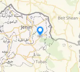
Jalqamus
Jalqamus —arabieraz: جلقموس, Jalqamūs— Jeningo Gobernazioko palestinar hiria da, Zisjordanian. Palestinako Estatistika Bulego Zentralaren (PCBS) arabera, Jalqamus-ek 1.867 biztanle zituen 2007an.[1]
| Jalqamus | |
|---|---|
| herrixka | |
| Administrazioa | |
| Occupied territory | Zisjordania |
| Palestina Estatuko lurralde-antolaketa | Jeningo Gobernazioa |
| Geografia | |
| Koordenatuak | 32°25′27″N 35°21′50″E |
 | |
| Demografia | |
| Informazio gehigarria | |
| Ordu eremua | UTC+02:00 eta UTC+03:00 |
Historia
1882an, Palestine Exploration Fund-eko Survey of Western Palestine txostenak honela deskribatu zuen Jelqamus: «Herri txiki bat muino baten gailurrean, lur goldatuaz inguratua, olibondo batzuekin, harriz eta lokatzez eraikia, euri-urezko zisternekin». 1922ko Palestinako zentsuan, britainiar agintariek egina, biztanleak 124 musulman ziren, Geroago 1931an 150 musulman ziren 31 etxetan.[2][3][4]
1944/5ean, Jalqamus-eko biztanleak 220 musulman ziren, eta 4,437 dunam lur zituen, lurraren eta populazioaren errolda ofizial baten arabera.[5][6] Horietatik 180 dunam erabiltzen zituzten landaketek eta ureztalurrek, 2.422 zerealek, eta 6 dunam, berriz, lurzoru eraikigarriak ziren.[7][8]
1948ko arabiar eta israeldar gerraren ondorioz, eta 1949ko arabiar eta israeldarren armistizio-akordioen ondoren, Jordanian sartu zuten Jalqamus, eta 1967ko Sei Egunetako Gerraz geroztik, israeldarren mende egon da.
Erreferentziak
- Table 26 (Cont.): Localities in the West Bank by Selected Indicators, 2007. Palestinian Central Bureau of Statistics.
- Conder and Kitchener, 1882, SWP II, p. 85
- Barron, 1923, Table IX, Sub-district of Jenin, p. 29
- Mills, 1932, p. 68
- Department of Statistics, 1945, p. 16
- Government of Palestine, Department of Statistics. Village Statistics, April, 1945. Quoted in Hadawi, 1970, p. 54
- Government of Palestine, Department of Statistics. Village Statistics, April, 1945. Quoted in Hadawi, 1970, p. 98
- Government of Palestine, Department of Statistics. Village Statistics, April, 1945. Quoted in Hadawi, 1970, p. 148
Bibliografia
- Barron, J.B.. Palestine: Report and General Abstracts of the Census of 1922. Government of Palestine, 1923.
- Conder, Claude Reignier; Kitchener, H.H.. The Survey of Western Palestine: Memoirs of the Topography, Orography, Hydrography, and Archaeology. 2. Londres: Committee of the Palestine Exploration Fund, 1882.
- Hadawi, S.. Village Statistics of 1945: A Classification of Land and Area ownership in Palestine. Palestine Liberation Organization Research Center, 1970.
- Mills, E.. Census of Palestine 1931. Population of Villages, Towns and Administrative Areas. Jerusalem: Government of Palestine, 1932.
- Palmer, E.H.. The Survey of Western Palestine: Arabic and English Name Lists Collected During the Survey by Lieutenants Conder and Kitchener, R. E. Transliterated and Explained by E.H. Palmer. Committee of the Palestine Exploration Fund, 1881.
Kanpo estekak
- Welcome To Jalqamus
- Jalqamus, Welcome to Palestine
- Survey of Western Palestine, Map 9: IAA, Wikimedia commons