| South Gloucestershire | ||||
|---|---|---|---|---|
| Unuara instanco | ||||
| unitary authority area in England [+] | ||||
| Lando | Anglio | |||
| Koordinatoj | 51° N, 2° U (mapo)51.479444444444-2.3802777777778Koordinatoj: 51° N, 2° U (mapo) | |||
| Ĉefurbo | Yate | |||
| - koordinatoj | 51° N, 2° U (mapo)51.479444444444-2.3802777777778Koordinatoj: 51° N, 2° U (mapo) [+] | |||
| Areo | 496,9473 km² (49 695 ha) [+] | |||
| Loĝantaro | 282 644 [+] (2018) | |||
| ISO 3166-2 | GB-SGC | |||
|
||||
|
||||
 |
||||
| South Gloucestershire | ||||
| En TTT: Oficiala retejo [+] | ||||

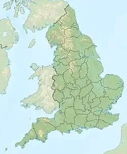
South Gloucestershire estas unuara instanco en la angla regiono South West England.
Ĝi estis antaŭe parto de la provinco Gloucestershire kaj poste Avon.
- Loĝantaro - 239 000 (1997)
- Areo - 497 km²
Urboj kaj vilaĝoj
- Bradley Stoke
- Filton
- Kingswood
- Thornbury
- Yate
- Abson
- Almondsbury
- Alveston
- Chipping Sodbury
- Dyrham
- Doynton
- Hinton
- Little Stoke
- Olveston
- Patchway
- Pucklechurch
- Rudgeway
- Wick
- Winterbourne
Vidu ankaŭ
Loka regado kaj administrado en Britio

This article is issued from Wikipedia. The text is licensed under Creative Commons - Attribution - Sharealike. Additional terms may apply for the media files.