| Santa Isabel | |||
|---|---|---|---|
| municipo de Brazilo | |||
|
| |||
| Blazono | |||
| Administrado | |||
| En TTT | Oficiala retejo [+] | ||
| Demografio | |||
| Loĝantaro | 3 538 (2022) [+] | ||
| Loĝdenso | 4 loĝ./km² | ||
| Geografio | |||
| Geografia situo | 15° 18′ S, 49° 26′ U (mapo)-15.297777777778-49.426944444444Koordinatoj: 15° 18′ S, 49° 26′ U (mapo) [+] | ||
| Alto | 611 m [+] | ||
| Areo | 806,814 km² (8 068 1.4 ha) [+] | ||
 | |||
| |||
|
| |||
| Alia projekto | |||
.jpg.webp)


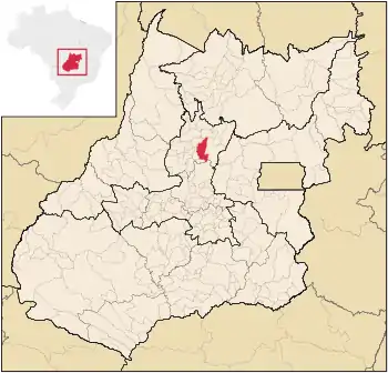
Santa Isabel estas municipo de la brazila subŝtato Gojaso, kiu taksis 3.686 loĝantojn en 2010 [1].
Subŝtate
Vidu ankaŭ
Eksteraj ligiloj
Referencoj
- ↑ IBGE (2010). Censo 2010 (HTML). Alirita 03 de setembro 2011.
Koordinatoj: 15° 17′ 52″ S 49° 25′ 37″ U / 15.297778 °S, 49.426944 °U (mapo)
This article is issued from Wikipedia. The text is licensed under Creative Commons - Attribution - Sharealike. Additional terms may apply for the media files.