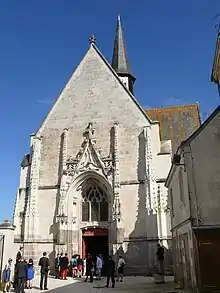
| Sainte-Catherine-de-Fierbois | |||
|---|---|---|---|
| komunumo | |||
 | |||
| komunumo en Francio | |||
|
| |||
| Blazono | |||
| Administrado | |||
| Regiono | Centro-Valo de Luaro | ||
| Departemento | |||
| Arondismento | Tours | ||
| Kantono | Sainte-Maure-de-Touraine | ||
| INSEE kodo | 37212 [+] | ||
| Poŝtkodo | 37800 | ||
| En TTT | Oficiala retejo [+] | ||
| Demografio | |||
| Loĝantaro | 789 (2021) [+] | ||
| Loĝdenso | 51 loĝ./km² | ||
| Geografio | |||
| Geografia situo | 47° 9′ N, 0° 39′ O (mapo)47.15750.6536111111111Koordinatoj: 47° 9′ N, 0° 39′ O (mapo) [+] | ||
| Areo | 15,49 km² (1 549 ha) [+] | ||
 | |||
| |||
| |||
|
| |||
| Alia projekto | |||

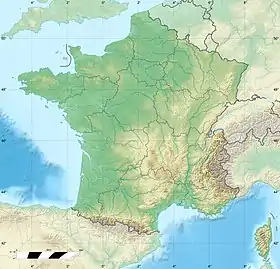

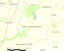
Sainte-Catherine-de-Fierbois estas komunumo de Francio. Ĝi situas en la departemento Indre-et-Loire, prononco [ɛ̃dʁelwaʁ] kaj en la regiono Centro-Valo de Luaro, france Centre-Val de Loire, prononco [sɑ̃tʁə val də lwaʁ], borde de la rivero Luaro. Fine de 2021 en la komunumo vivis 789 loĝantoj. Administre la komunumo apartenas al la arondismento Tours kaj al la kantono Sainte-Maure-de-Touraine. Ĝi etendiĝas sur 15,49 km².
Blazono
.svg.png.webp) Blazono de Sainte-Catherine-de-Fierbois
Blazono de Sainte-Catherine-de-Fierbois
Vidu ankaŭ
Eksteraj ligiloj
This article is issued from Wikipedia. The text is licensed under Creative Commons - Attribution - Sharealike. Additional terms may apply for the media files.