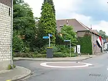
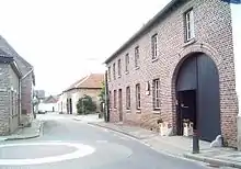
Ransdaal (limburge: Ranzel) (50° 52′ N 5° 53′ O / 50.867 °N, 5.883 °O (mapo)Koordinatoj: 50° 52′ N 5° 53′ O / 50.867 °N, 5.883 °O (mapo)) estas kirkvilaĝo kiu situas en la Ransdalerveld (Kampo de Ransdaal) en la komunumo Voerendaal provinco Limburgo Nederlando kaj havas ĉ. 1000 loĝantojn. Ransdaal apartenis ĝis 1940 parte al la antaŭa komunumo Schin op Geul kaj parte al la antaŭa komunumo Valkenburg kaj poste al Klimmen kaj Wijlre ĝis la komunuma rearanĝo je la 1-a de januaro 1982.
Esperanto
En Ransdaal estas Esperantoplaco (vidu:Listo de ZEO-j en Nederlando)
Koordinatoj: 50° 51′ 10″ N; 5° 53′ 12″ E Mapo
Strataro en Ransdaal
- Dorpsplein
- Dr. Huntjesstraat
- Drie Herenweg
- Esperantoplein
- Gebergastraat
- Hubert Houbenstraat
- Kampstraat
- Korte Weg
- Leo Dohmenstraat
- Pastoor Laevenstraat
- Ransdalerstraat
- Ranzearstraat
- Rootveldstraat
- Spaanshof
- Spoorstraat
- Staatsland
- St. Gillisstraat

Terezia kirko

Puŝpinglo en la direkto de la stacidomo

Vidaĵo de la vilaĝo

Kirko
.JPG.webp)
Stacidomo
This article is issued from Wikipedia. The text is licensed under Creative Commons - Attribution - Sharealike. Additional terms may apply for the media files.