| Piraquara | |||||
|---|---|---|---|---|---|
 | |||||
| municipo de Brazilo • urbego | |||||
|
|
| ||||
| Flago | Blazono | ||||
| Administrado | |||||
| |||||
| En TTT | Oficiala retejo [+] | ||||
| Demografio | |||||
| Loĝantaro | 118 730 (2022) [+] | ||||
| Loĝdenso | 522 loĝ./km² | ||||
| Geografio | |||||
| Geografia situo | 25° 27′ S, 49° 4′ U (mapo)-25.441944444444-49.062777777778Koordinatoj: 25° 27′ S, 49° 4′ U (mapo) [+] | ||||
| Alto | 897 m [+] | ||||
| Areo | 227,56 km² (22 756 ha) [+] | ||||
 | |||||
|
| |||||
| Alia projekto | |||||


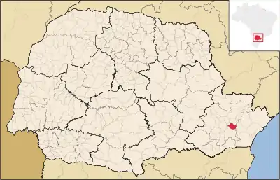
Piraquara estas municipo de la brazila subŝtato Paranao, kiu taksis 93.279 loĝantojn en 2010 [1].
Subŝtate
Referencoj
- ↑ IBGE (2010). Censo 2010 (HTML). Alirita 24 de aŭgusto 2011.
Vidu ankaŭ
Eksteraj ligiloj
This article is issued from Wikipedia. The text is licensed under Creative Commons - Attribution - Sharealike. Additional terms may apply for the media files.