| Municipo Peel en Maas | ||
|---|---|---|
|
|
| |
| Flago de la municipo Peel en Maas | Blazono de municipo Peel en Maas | |
 | ||
| nederlanda municipo | ||
| Provinco | Limburgo | |
| Ĉefloko | Panningen | |
| Areo - Tero - Akvo |
161,35 km² 159,44 km² 1,91 km² | |
| Loĝantaro - Loĝdenso |
43 298 (1-a de januaro 2014) 272 loĝ./km² | |
| Geografia situo | 51° 20′ N, 6° 1′ O (mapo)51.3333333333336.0166666666667Koordinatoj: 51° 20′ N, 6° 1′ O (mapo) | |
| ||
|
| ||
| Gravaj trafikaj arterioj | A67, A73 | |
| CBS-municipokodo | 1894 | |
| Poŝtkodo | 5768, 5980–5981, 5984–5988, 5990–5991, 5993, 5995 | |
| Oficiala retejo | https://www.peelenmaas.nl/ | |
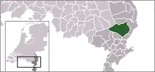
Peel en Maas estas nova municipo ekde la 1-a de januaro 2010 en la sudorienta Nederlando. Ĝi estas situanta en la provinco Limburgo. La municipo estas formita fare de la antaŭaj municipoj Helden, Kessel, Maasbree kaj Meijel.
Eksteraj ligiloj
- www.peelenmaas.nl

| Provinco Limburgo | |
|---|---|
| Beek | Beekdaelen | Beesel | Bergen | Brunssum | Echt-Susteren | Eijsden-Margraten | Gennep | Gulpen-Wittem | Heerlen | Horst aan de Maas | Kerkrade | Landgraaf | Leudal | Maasgouw | Mastriĥto | Meerssen | Mook en Middelaar | Nederweert | Peel en Maas | Roerdalen | Roermond | Schinnen | Simpelveld | Sittard-Geleen | Vaals | Valkenburg aan de Geul | Venlo | Venray | Voerendaal | Weert | |
| Nederlando | Provincoj | Municipoj | |
This article is issued from Wikipedia. The text is licensed under Creative Commons - Attribution - Sharealike. Additional terms may apply for the media files.


