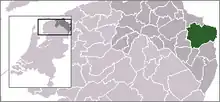
| Municipo Oldambt | ||
|---|---|---|
|
|
| |
| Flago de la municipo Oldambt | Blazono de municipo Oldambt | |
 | ||
| nederlanda municipo | ||
| Provinco | Groningo | |
| Urbestro | Cora-Yfke Sikkema | |
| Ĉefloko | Winschoten | |
| Areo - Tero - Akvo |
396,42 km² 234,46 km² 61,96 km² | |
| Loĝantaro - Loĝdenso |
39.428 (1-a de januaro 2010) 167 loĝ./km² | |
| Geografia situo | 53° 9′ N, 7° 2′ O (mapo)53.157.0333333333333Koordinatoj: 53° 9′ N, 7° 2′ O (mapo) | |
| ||
|
| ||
| Gravaj trafikaj arterioj | A7, N362; fervojlinio Groningen-Nieuweschans | |
| CBS-municipokodo | 1895 | |
| Poŝtkodo | 9670–9682, 9684–9694, 9940–9944 | |
| Oficiala retejo | https://www.gemeente-oldambt.nl/ | |
Oldambt estas municipo en nederlanda orienta Groningen kiu ekestis je la 1-a de januaro 2010 el kunfandiĝo de la municipoj Scheemda, Winschoten kaj Reiderland. Je la 1-a de januaro 2010 la municipo havis 39 428 loĝantojn (el Reiderland: 6 968, el Scheemda 14 165 kaj el Winschoten 18 295).
Setlejoj
Vidu ankaŭ
| Provinco Groningo | |
|---|---|
| Eemsdelta | Groningo | Het Hogeland | Midden-Groningen | Oldambt | Pekela | Stadskanaal | Veendam | Westerkwartier | Westerwolde | |
| Nederlando | Provincoj | Municipoj | |
This article is issued from Wikipedia. The text is licensed under Creative Commons - Attribution - Sharealike. Additional terms may apply for the media files.


