| Municipo Maasgouw | ||
|---|---|---|
|
|
| |
| Flago de la municipo Maasgouw | Blazono de municipo Maasgouw | |
 | ||
| nederlanda municipo | ||
| Provinco | Limburgo | |
| Urbestro | Dion Schneider | |
| Ĉefloko | Maasbracht | |
| Areo - Tero - Akvo |
57,99 km² 45,83 km² 12,16 km² | |
| Loĝantaro - Loĝdenso |
23 888 (1-a de januaro 2014) 521 loĝ./km² | |
| Geografia situo | 51° 9′ N, 5° 52′ O (mapo)51.155.8666666666667Koordinatoj: 51° 9′ N, 5° 52′ O (mapo) | |
| ||
|
| ||
| Gravaj trafikaj arterioj | A2, A73 | |
| CBS-municipokodo | 1641 | |
| Telefona kodo | 475 | |
| Poŝtkodo | 6017, 6019, 6050–6051, 6067, 6097, 6099, 6107, 6109 | |
| Oficiala retejo | https://www.gemeentemaasgouw.nl/ | |
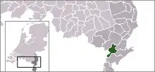
Maasgouw estas municipo en la nederlanda provinco Limburgo, kiu estiĝis en 2007 kiel kunigaĵo de la antaŭaj municipoj Heel, Maasbracht kaj Thorn. La nomo Maasgouw estas kunigo de Maas kaj Gouw. Maas estas la rivero kiu ligas la 3 antaŭajn municipojn. Gouw signifas regionon.
La municipo nun konsistas el la urboj Beegden, Heel en Panheel, Linne, Maasbracht/Brachterbeek, Ohé en Laak, Stevensweert, Thorn kaj Wessem.
Eksteraj ligiloj

| Provinco Limburgo | |
|---|---|
| Beek | Beekdaelen | Beesel | Bergen | Brunssum | Echt-Susteren | Eijsden-Margraten | Gennep | Gulpen-Wittem | Heerlen | Horst aan de Maas | Kerkrade | Landgraaf | Leudal | Maasgouw | Mastriĥto | Meerssen | Mook en Middelaar | Nederweert | Peel en Maas | Roerdalen | Roermond | Schinnen | Simpelveld | Sittard-Geleen | Vaals | Valkenburg aan de Geul | Venlo | Venray | Voerendaal | Weert | |
| Nederlando | Provincoj | Municipoj | |
This article is issued from Wikipedia. The text is licensed under Creative Commons - Attribution - Sharealike. Additional terms may apply for the media files.


