| Municipo Montfoort | ||
|---|---|---|
|
|
| |
| Flago de la municipo Montfoort | Blazono de municipo Montfoort | |
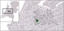 | ||
| nederlanda municipo | ||
| Provinco | Utreĥto | |
| Urbestro | Petra van Hartskamp-de Jong | |
| Ĉefloko | Montfoort | |
| Areo - Tero - Akvo |
38,22 km² 37,75 km² 0,47 km² | |
| Loĝantaro - Loĝdenso |
13.510 (1-a de novembro 2007) 353 loĝ./km² | |
| Geografia situo | 52° 2′ N, 4° 57′ O (mapo)52.0333333333334.95Koordinatoj: 52° 2′ N, 4° 57′ O (mapo) | |
| ||
|
| ||
| Gravaj trafikaj arterioj | N228, N204 | |
| CBS-municipokodo | 0335 | |
| Poŝtkodo | 3417 | |
| Oficiala retejo | https://www.montfoort.nl/ | |


![]() Montfoort (52° 2′ N, 4° 57′ O (mapo)52.0333333333334.95
)
estas urbo kun urborajtoj kaj municipo en la nederlanda provinco Utrecht.
Montfoort (52° 2′ N, 4° 57′ O (mapo)52.0333333333334.95
)
estas urbo kun urborajtoj kaj municipo en la nederlanda provinco Utrecht.
La municipo havis (je la 1-a de novembro 2007) 13 510 loĝantojn kaj havas areon de 38,22 km².

Montfoort

Kastelo Montfoort

La silueto de Montfoort

Mapo el ĉ.1649 fare de Joan Blaeu
| Provinco Utreĥto | |
|---|---|
| Amersforto | Baarn | Bunnik | Bunschoten | De Bilt | De Ronde Venen | Eemnes | Houten | IJsselstein | Leusden | Lopik | Montfoort | Nieuwegein | Oudewater | Renswoude | Rhenen | Soest | Stichtse Vecht | Utrechtse Heuvelrug | Utreĥto | Veenendaal | Vijfheerenlanden | Wijk bij Duurstede | Woerden | Woudenberg | Zeist | |
| Nederlando | Provincoj | Municipoj | |
This article is issued from Wikipedia. The text is licensed under Creative Commons - Attribution - Sharealike. Additional terms may apply for the media files.