
| Municipo Leusden | ||
|---|---|---|
|
|
| |
| Flago de la municipo Leusden | Blazono de municipo Leusden | |
 | ||
| nederlanda municipo | ||
| Provinco | Utreĥto | |
| Urbestro | Gerolf Bouwmeester | |
| Ĉefloko | Leusden | |
| Areo - Tero - Akvo |
62,02 km² 61,68 km² 0,34 km² | |
| Loĝantaro - Loĝdenso |
28.731 (1-a de julio 2006) 466 loĝ./km² | |
| Geografia situo | 52° 8′ N, 5° 25′ O (mapo)52.1333333333335.4166666666667Koordinatoj: 52° 8′ N, 5° 25′ O (mapo) | |
| ||
|
| ||
| CBS-municipokodo | 0327 | |
| Telefona kodo | 033 | |
| Poŝtkodo | 3830–3834 | |
| Oficiala retejo | http://www.leusden.nl/ | |


![]() Leusden (52° 8′ N, 5° 25′ O (mapo)52.1333333333335.4166666666667
)
estas municipo kaj loĝloko en la nederlanda provinco Utrecht. La municipo havis (je la 1-a de julio 2006) 28 731 loĝantojn kaj havas areon de 62,02 km² (de kiu 0,34 km² estas akvo).
Leusden (52° 8′ N, 5° 25′ O (mapo)52.1333333333335.4166666666667
)
estas municipo kaj loĝloko en la nederlanda provinco Utrecht. La municipo havis (je la 1-a de julio 2006) 28 731 loĝantojn kaj havas areon de 62,02 km² (de kiu 0,34 km² estas akvo).

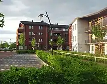
Prins Clausplein
| Provinco Utreĥto | |
|---|---|
| Amersforto | Baarn | Bunnik | Bunschoten | De Bilt | De Ronde Venen | Eemnes | Houten | IJsselstein | Leusden | Lopik | Montfoort | Nieuwegein | Oudewater | Renswoude | Rhenen | Soest | Stichtse Vecht | Utrechtse Heuvelrug | Utreĥto | Veenendaal | Vijfheerenlanden | Wijk bij Duurstede | Woerden | Woudenberg | Zeist | |
| Nederlando | Provincoj | Municipoj | |
This article is issued from Wikipedia. The text is licensed under Creative Commons - Attribution - Sharealike. Additional terms may apply for the media files.