| Irati | |||
|---|---|---|---|
 | |||
| municipo de Brazilo | |||
|
|
| ||
| Flago | Blazono | ||
| Administrado | |||
| En TTT | Oficiala retejo [+] | ||
| Demografio | |||
| Loĝantaro | 59 250 (2022) [+] | ||
| Loĝdenso | 59 loĝ./km² | ||
| Geografio | |||
| Geografia situo | 25° 28′ S, 50° 39′ U (mapo)-25.466944444444-50.650833333333Koordinatoj: 25° 28′ S, 50° 39′ U (mapo) [+] | ||
| Alto | 812 m [+] | ||
| Areo | 999,515 km² (9 995 1.5 ha) [+] | ||
 | |||
| |||
|
| |||
| Alia projekto | |||


Irati estas municipo de la brazila subŝtato Paranao, kiu taksis 56.288 loĝantojn en 2010 [1].
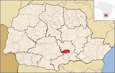
En la subŝtato (ruĝe).
Referencoj
- ↑ IBGE (2010). Censo 2010 (HTML). Alirita 15 de aŭgusto 2011.
Vidu ankaŭ
Eksteraj ligiloj
This article is issued from Wikipedia. The text is licensed under Creative Commons - Attribution - Sharealike. Additional terms may apply for the media files.